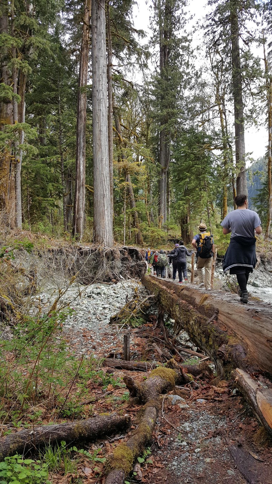
Day 4 - Friday, July 19 - Mile 1953.9 to 1960.8, Elk Lake Resort to South Sister, 10.7 miles
I sleep pretty well in the hotel and take us all out for breakfast at a restaurant called The Breakfast Club in the morning. It is close to the hotel and seems like the kind of diner that the locals know and love. Kelley and I have eggs benedict with spinach added for extra iron while Laurie has sausage and eggs. Afterwards we pick up a couple things from Safeway and then collect our things from the hotel and head back to the trail.
It is a good ride back and we have a great discussion about spirituality, free will, love versus not love, and how surviving something horrible and seeing yourself as a survivor versus a victim can also be a type of top life experience. We talk about our memories of our grandmother and it is interesting to hear their perceptions of her.
We arrive back to the trail around 10:00 am and a man carrying an assault rifle offers to take our picture for us, which we accept and then afterwards murmur to each other,"Why does he have a gun? It doesn't seem like a good idea to be shooting around here with so many hikers." But he seems like a nice guy and even offers to let us have his parking spot since he is leaving.
 |
| We finally have the required permit at this trail head |
 |
| The official picture |
20/20 and I are not purists and don't care about going up the same trail we came down to connect our steps, so we take the Horse Lake Trail back up to the PCT, which is a 1.5 mile trail that puts us on the PCT around mile 1953.9. This is a good choice since it is shadier and less steep than the trail we took down to Elk Lake Resort. We still have to stop for frequent rest breaks and I wonder if I will ever get used to the higher altitude.

The trail rises up to Koosah Mountain at 6,425 feet and up at the top we meet PCT hiker Hannah (no trail name yet) who takes our picture and we take hers for her. We have cell service along with warm red cinder rocks to sit on, and we take a lunch break there. A kaleidoscope (Yep, that is the official name of a group of butterflies. Thanks, Google.) of orange butterflies have swarmed us along the trail today.

 |
| View from Koosah Mountain |
 |
| We made it to the top! |
 |
| Orange butterfly |
 |
| Mt. Bachelor |
After lunch we start the descent down the mountain to Sisters Mirror Lake where we filter some water. I discover that I have left my water bottle in Bend and now have to rely completely on my platypus water bladder, so I add two liters to it.
 |
| South Sister and Middle Sister |
 |
| Indian Paintbrush |
 |
| Filtering water at Sisters Mirror Lake, mile 1958.8 |
 |
| Pretty lake, but mosquito hell! |
Sisters Mirror Lake is buzzing with mosquitoes, though, and we decide to go further down the trail to find some where else to camp. I find a small bottle of mosquito repellent that some unlucky hiker lost when it rolled beneath a rock and we take it with us, which is a good choice because our repellents will both run out before we finish our hike and that will be what saves the day.
I must be getting tired because I almost take the wrong trail twice but Kelley is paying attention and gets us back on track both times. We ascend several hundred feet and come out onto an amazing high alpine meadow with South Sister looming in front of us.

We can't find the campsite that the maps indicate and instead decide to find our own. We leave the trail and come upon a site that others have used before. There is a small fire ring with several cleared spots and we set up our tents to face South Sister. It is our most epic camping spot, ever.

I decide to leave the rain fly off since I want to try to see the stars and we eat white bean turkey chili and then sit in our tents and talk. There are a few mosquitoes, but it is definitely better than Sisters Mirror Lake. We agree that the views today have been the best of the entire trip.
 |
| I've got this feeling, somebody's watching me |
 |
| South Sister in the alpenglow |
 |
| Snug as a bug in my comfy tent |
Day 5 - Saturday, July 20, Mile 1960.8 to 1969.6, South Sister to Linton Meadow area, 8.8 miles
I sleep terrible since my head is pointing down hill a bit and I am disappointed to discover that the gray/beige of my netting does not allow me to see the stars clearly. I wake up to find myself and my sleeping bag drenched with dew. I am surprised by this since we are so high and we are not near any water source. The rising sun quickly dries out our tents and sleeping bags and we pack up and start down the trail.

I look at the Rock Mesa and it looks like a wall of lava stopped for some unknown reason right along the meadow and I wonder if there was a lake here that caused the lava to stop and form a high wall. We get to Mesa Creek where we get a bit more water and then start descending. We enter another meadow area at Mesa Creek and several people are camped there who are packing up.
 |
| Mesa Creek |

Then we start ascending once again and go through another burned area. This ascent seems difficult and we stop to catch our breath where a thru hiker is sitting and resting. We start to chat and I discover that this hiker is named Silver. And last year he hiked the Appalachian Trail with the Crawfords, known as The Family, who vlogged about their hike on the AT with their six children. I started watching their vlogs last year on You Tube. The vlog is called "Fight for Together," and it is wonderful.
It is always kind of strange to meet in real life someone that you know from social media. We talk with him for quite awhile before continuing on our way.
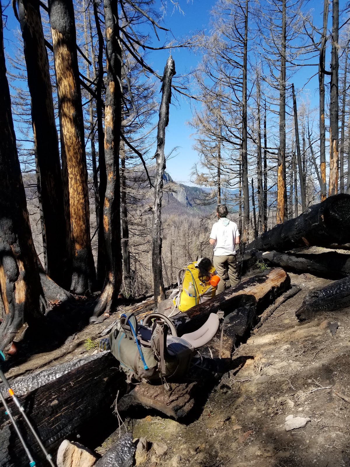 |
| Another burned area |
 |
| Gray forest of dead trees |
Eventually we come to another small stream and I decide to soak my feet in the cold mountain water. It is a warm sunny day and the water feels delicious.
 |
| Middle Sister |
 |
| A cold foot bath is so refreshing |
 |
| Hinton Creek |
We debate filtering water here, but we still have some in our bladders and we have another ascent with a pond ahead so we decide to push on to the pond. The pond turns out to be a clear lovely little lake and we eat lunch here and then filter water.
 |
| Our lunch view of South Sister |
 |
| Middle Sister ahead |
Then we start another ascent and just past Linton Meadow Trail we start to look for a place to camp. We are approaching the Obsidian Limited Entry area and we do not have the special permit needed to camp in that area, but the trail is steep and there are not any good places to camp. We finally see a campsite right beside the trail and we plop our things down and set up camp.
 |
| Desperation camping spot |
I normally don't like to camp this close to the trail, but we are afraid we won't find anything better. It is hot and sunny and the mosquitoes are out in full force. We are forced into our sweltering tents to escape the hungry hordes. A hiker limps past us on his way down the trail to a little stream for water and we chat a bit. He's been hiking since Ashland but plans to get off trail tomorrow. He's been chased by mosquitoes for almost 500 miles and he is Done. A special education teacher from San Francisco, he is camped just up the trail from us with his hiking partner and seems like a very nice older gentleman. I am happy to have someone else camping within shouting distance of us.
I re-hydrate my turkey casserole but even after 1.5 hours the turkey is a little crunchy. I feel better after I eat. We are camped at 6,500 feet and I hope that sleeping at this elevation will help me get more red blood cells so I can hike without stopping to catch my breath so much. Once the sun drops down on the horizon and my tent becomes shaded, the temperature in the tent quickly drops from 86 degrees to 70 degrees. I am tired and I fall asleep quickly.
Day 6 Sunday, July 20 - Mile 1969.6 to 1981.9, Obsidian Limited Entry to North Matthieu Lake, 12.3 miles
We wake up at 6:30 an and are packed and on the trail by 7:30 am. Kelley has me take a picture of her with the South Sister behind her and later that day I scroll through the pictures with my reading glasses on and burst out laughing. I really need to put my bifocals on when I take pictures, since I can't clearly see the picture I am taking. I have apparently been a middle school teacher for too long, because in the picture Kelley has her hat behind her but the angle perfectly makes it look like she has an extra, um, appendage.

Kelley is low on water so we hoof it up to Obsidian Falls and then on to Sister Spring. At Sister Spring the water is coming directly from the glacier so we don't need to filter it and we dip our cup into the spring to fill our water bladders. The water is cold and delicious, the best water I think I've ever had. I fill up two liters and Kelley fills up 2.5 liters plus her smart water bottle, but the weight of all that water is excruciating and she ends up dumping her water bottle later on down the trail.
 |
| Obsidian Falls |
 |
| Hard to see in the picture but the water is coming out of the large center rock |
 |
| North Sister. Stunning. |
I've been feeling a prompting to put my sunglasses on for awhile so I take the opportunity to fish them out of my pack and put them on. I take a little potty break and look at my knees and realize that this could have been much worse. I tripped on the one soft spot on the trail today and nothing is broken or bleeding.
 |
| Glad I didn't trip here! |

 |
| Lava wall to the left |
 |
| Another break to catch our breath |
 |
| Such an interesting muffin top tree |
 |
| Roots growing out of the rock |
Every time I think we are done another switchback appears. We climb to almost 7,000 feet, the highest spot on the entire trip.
 |
| Looking back at what we just climbed up |

When we get to what I think is the top I look at the trail going up the mountain ahead and some non-Pentecostal verbage flies out of my mouth before I can stop it. Fortunately that is only a side excursion and our trail curves to the left. The ascent is over. We take a celebratory picture together at the top. Toughest part of the trail (we think) done!

 |
| Walking on lava rock at 7,000 feet |
 |
| We eat lunch on that rock formation as we gaze at the view |
 |
| Kelley at our lunch spot |
When we finish lunch it is time to descend. There is a snow field covering part of the trail and I grip my poles tightly as I carefully go down. It strains my hurt wrist and it is throbbing pretty good by the time we are done. Kelley suddenly realizes that her butt is wet. Her hydration bladder has sprung a leak and water is running down her backside. Fortunately we are just down from another glacier spring called Minnie Scott. We stop and she pulls out her bladder and looks at it but can't figure out where the leak is. Possibly the seal. She puts the bladder into a plastic bag and then needs to fill up her empty bottle, so we trot over to where the spring is and she fills her bottle. A snow patch is right next to it, and I scrap out some snow into my bandanna, roll it up into a long bandage and tie it around my wrist as an ice pack. It is so cold that pain shoots clear up into my elbow from the chill, but it definitely makes my wrist feel better.
On we go. We cross a beautiful meadow. The scenery is so varied today! High alpine, waterfalls, springs, forest, desolate lava and meadows filled with wildflowers.
 |
| North and Middle Sisters behind us |
 |
| All Three Sisters behind us |
It is late afternoon when we finally arrive at South Matthieu Lake. All three tent sites are in the sun and the mosquitoes are out and we really don't want to swelter in our tents for hours like the previous night so we decided to go on to North Matthieu Lake, which has seven campsites and has a better chance of having a tent site in the shade.
Down, down, down we go and North Matthieu is a pleasant looking lake and we quickly stake out the first shady campsite we see. We head to the lake and Kelley wades in up to her knees and dips her head in. I wash my feet and legs and rinse out my socks and we sit in the sun and talk while a family with a dog and two boys swims around the lake. The father stands up in the middle of the lake and it is only up to his waist.
 |
| North Matthieu Lake |
 |
| Nice shady campsite, but lots of mosquitoes |
After we set up our tents we go back to the lake to get water to filter and meet SOBO hikers Bison and Honey from the Czech Republic. They take the campsite next to us, but all the campsites are so far apart that we don't see or hear them again. After filtering the water I re-hydrate my split pea soup. It is the grossest thing I've ever tasted and I vow to throw it all away as soon as I get home. A couple months ago I thought it was fabulous but apparently my tastes have changed.
The mosquitoes chase us to our tents and I take a wet wipe to scrub myself. The amount of dirt covering me is a bit disturbing, and my shirt is so sweaty and stinky that I can barely stand to have it in the tent with me. I should have washed that, too. Being in the trees, the darkness falls quickly and I sleep.
Day 7 - Monday, July 22 - Mile 1979.8 to 1995.1, North Matthieu Lake to Big Lake Youth Camp, 15.1 miles.
We wake up at 5:30 and are walking the trail by 6:30 am. We want to get through the lava fields ahead before the heat of the afternoon. I misread the map and expected an ascent but instead we descend several more hundred feet until we pop back out on the official PCT again. We arrive to the cut off to Lava Lake Camp, our last chance to fill up on water for over 12 miles and we head to the lake. First stop, pit toilet! I hoped there would be a trash can to dump our trash, but there is not. At the lake we filter water and fill up our water bladders. Kelley fills up her leaky bladder half way, and her smart water bottle. I fill up 2.5 liters.

We shoulder our water heavy packs and head back down the trail, where we quickly enter the lava field. Lava is hard to walk on. It is hard under the feet and can be unstable and roll under your feet as well. It takes intense concentration for each step. We are picking our way across an immense plateau of lava and a stiff breeze cools us and blows all the mosquitoes away. Finally, no need for any mosquito netting!

We cross Hwy 242 and continue through the lava on the other side for awhile until we come out to a trail head marking the termination of Three Sisters Wilderness and the entrance to Mt. Washington Wilderness. A new permit is needed and I fill out the form for Mt. Washington Wilderness and shove it in the box. I can feel a hot spot on my left heel and Kelley gives me a piece of moleskin to apply to it.
Then we begin a 1200 foot ascension. We are out of the lava and on a dusty dirt trail and my feet are happy for the break. I look at the map and we will be going through another lava field ahead but for now we enjoy the dirt.
But a problem is brewing. I can feel chafe starting on the inside of my right thigh. Right before we enter the lava field again, I take a pee break. I have a small tube of bag balm and I smooth some onto the raw spot, which does help. For awhile.
We continue slowly up the lava field, concentrating on each step. Because we have to watch our feet we can't look out at the view. The rocks are sharp and jaggedy so whenever we pause to catch our breath we can't sit for the break because the rocks are so uncomfortable, and we stand resting on our hiking poles.
After what feels like an eternity, we reach the top and are back on dirt. We stop for lunch and sit on an old tree log in the shade, so happy and grateful to be done with the lava. The map shows regular terrain ahead. And when we start again for awhile it is regular dirt trail. Then we begin to descend and we are on lava again, but it is older lava that had trees and vegetation that a fire wiped out when it came through the area. But most of the path is lava rocks which I was not expecting and I am becoming super frustrated with. Since I am walking north the sun is behind me which obscures where I am placing my feet in shadow, so once again I am taking small steps, going very slowly, trying not to fall.
I am so frustrated that I feel tears well up in my eyes. But I don't want to cry because that will make it even harder to see the path! Part of the frustration is knowing that Big Lake Youth Camp is ahead of us, beckoning us with showers and laundry and good food, but we have to go so slow that we probably won't make it there tonight. I express my frustrations to Kelley and she is on board with wanting to get to Big Lake tonight rather than dry camp. We decide we will just hike until we get there, even if it takes us until 9:00 pm.
We finally stop going down, go around the edge of the lava field, and begin another ascent, this time on dirt trail. It is another burned area, so stark gray remains of trees litter the hillside, but it is green and full of wildflowers and ferns.
We pause occasionally to catch our breath and the blister on my left heel is hurting, and the chafe on my right thigh is hurting, and I am waddling as I walk, trying to find a way to walk without pain. Eventually I take everything off and put on my rain skirt and hike in that, trying to find relief. That is better but I still am in pain, and I just grit my teeth and carry on. What else is there to do?
We are hiking through a beautiful area on a continual downhill. Wildflowers abound and I wish I could appreciate the scenery but it is just one foot in front of another until we finally reach the side trail to Big Lake Youth Camp. Another mile and we arrive. A friendly young man shows us where to sign in, and a nice young woman tells us the rules and points us to the hiker hut. We have hiked over 15 miles today.
It is after 7:00 pm, so we have missed dinner, but the first thing we ask when we enter the hut is where the sign up is for showers. Both showers are open and available for use we are told. I hobble into a bathroom, strip off my filthy clothes and jump in the shower. A sign asks us to try to keep it to a three minute shower, but I am so filthy I know that won't really be possible. I quickly wash my hair and then turn the water off while I soap up my legs and scrub them with my hands. A stream of dirty water and soap trail down the the shower floor and I am pretty appalled by the dirt I am scrubbing off. After I've scrubbed myself, I turn the water back on and rinse everything off and then take the rubber scougie and try to clean the shower walls as well.
I dress myself in my clean leggings and a clean smart wool shirt and bundle up my dirty hiking shirt and shorts. Then I hobble out of the bathroom. The hiker hut is amazing. There are two bathrooms/showers, a section where resupply boxes are stacked neatly waiting for their people to arrive, an industrial sized laundry machine and dryer, a kitchenette with a microwave and oven with stove top and small refrigerator. In the mornings they serve Dutch Bros coffee to the hikers! The main room has a large table with chairs and more chairs around the perimeter of the room. Approximately ten hikers are hanging around in the room, most on their phones. There are ample plug-ins to charge electronics and wifi.
I pull out my charger and begin to charge my phone and Garmin. Kelley makes some instant potatoes for dinner and we share them. We had hoped to catch a ride up to my car but most of the staff have already left for the day so Kelley and I decide to camp by the lake for the night and probably just hike the six miles in the morning, depending on how my blister and chaff are doing. I post a few pictures to Facebook and see that John has called, so I go outside and call him back.
It is not good news. He drove himself to the hospital two days ago where a cat scan revealed kidney stones. But the ER doctor looked at his chart and saw that he'd been in there a few weeks previously with shortness of breath and since he was already having a cat scan for the kidney pain, he also scanned his heart. That scan revealed that his carotid artery is partially blocked. He was urged to visit his primary care physician and have a stress test done as soon as possible.
I am beside myself when I hear it. I need to get home as quickly as possible, because this is serious. I go back in the hut and tell Kelley the news and that we need to get to my car and I need to get home. I look down at where we signed in and the office is dark so I call my nephew Eli who lives in Bend, and ask if he can come and get us and take us to our car. He looks at where we are and tells us he is almost 2 hours away from us, so we tell him we will wait for him in the dark at the entrance to the camp since PCT hikers need to leave the camp property by 9:30 pm. He has to wait until his wife gets home but he will be on his way shortly. A hiker comes over to me and tells me not to worry, everything will be okay, and he puts his hands on my shoulders and looks me in the eye as he tells me this, and I believe him.
I sit waiting and then feel like I just need to go down to the office and see if anyone is around. I walk down there and now the lights are on and people are in the office. As I walk up a young man starts to walk away and I ask him if he is a PCT hiker and he tells me that no, he works there. I start to cry as I explain to him and the young lady in the office that I have a family emergency and I need to get to my car which is parked at the Santiam Pass trailhead six miles away. I don't know if it is the tears or just that he is a very nice young man, but he agrees to drive me to my car. He will meet me in five minutes. I call Eli to let him know not to come, just as he is getting ready to go out the door. Good timing! I run into the hiker hut and tell Kelley that I have a ride for us and we stuff everything into our packs and black plastic bags and haul everything out to where the young man's car is.
Kelley sits in the front and asks the nice young man, Luke, questions about his car. She is so good at conversation and putting people at ease and he is delighted to tell her all about his car, which apparently is a special mix of a Saab and Subaru and is actually quite a rare car. As we drive through the dark I realize that it would have been very difficult for Eli to have found us in the dark on the windy dirt roads. We find my car parked off Hwy 20 at the Santiam PCT turn out and I force Luke to take a $20 for his time and trouble and we load up my car and head for Portland.
Since I've returned home it has been a whirlwind of doctor appointments and watching John in pain, trying to pass kidney stones. Not fun. Seeing someone you love in pain when you can do nothing to help is a frustrating feeling. We are still waiting to find out more about his heart.
It is interesting to me that this trip was through the Three Sisters Wilderness, where all the mountains are named for family relationships, like sister, brother, wife, husband, bachelor, and this trip was very much about family, sharing the trip with my cousins and being called home because of my husband. It seems appropriate.

We shoulder our water heavy packs and head back down the trail, where we quickly enter the lava field. Lava is hard to walk on. It is hard under the feet and can be unstable and roll under your feet as well. It takes intense concentration for each step. We are picking our way across an immense plateau of lava and a stiff breeze cools us and blows all the mosquitoes away. Finally, no need for any mosquito netting!

We cross Hwy 242 and continue through the lava on the other side for awhile until we come out to a trail head marking the termination of Three Sisters Wilderness and the entrance to Mt. Washington Wilderness. A new permit is needed and I fill out the form for Mt. Washington Wilderness and shove it in the box. I can feel a hot spot on my left heel and Kelley gives me a piece of moleskin to apply to it.
Then we begin a 1200 foot ascension. We are out of the lava and on a dusty dirt trail and my feet are happy for the break. I look at the map and we will be going through another lava field ahead but for now we enjoy the dirt.
But a problem is brewing. I can feel chafe starting on the inside of my right thigh. Right before we enter the lava field again, I take a pee break. I have a small tube of bag balm and I smooth some onto the raw spot, which does help. For awhile.
We continue slowly up the lava field, concentrating on each step. Because we have to watch our feet we can't look out at the view. The rocks are sharp and jaggedy so whenever we pause to catch our breath we can't sit for the break because the rocks are so uncomfortable, and we stand resting on our hiking poles.
 |
| Looking back at what we just came through. North Sister in the distance. |
After what feels like an eternity, we reach the top and are back on dirt. We stop for lunch and sit on an old tree log in the shade, so happy and grateful to be done with the lava. The map shows regular terrain ahead. And when we start again for awhile it is regular dirt trail. Then we begin to descend and we are on lava again, but it is older lava that had trees and vegetation that a fire wiped out when it came through the area. But most of the path is lava rocks which I was not expecting and I am becoming super frustrated with. Since I am walking north the sun is behind me which obscures where I am placing my feet in shadow, so once again I am taking small steps, going very slowly, trying not to fall.
I am so frustrated that I feel tears well up in my eyes. But I don't want to cry because that will make it even harder to see the path! Part of the frustration is knowing that Big Lake Youth Camp is ahead of us, beckoning us with showers and laundry and good food, but we have to go so slow that we probably won't make it there tonight. I express my frustrations to Kelley and she is on board with wanting to get to Big Lake tonight rather than dry camp. We decide we will just hike until we get there, even if it takes us until 9:00 pm.
We finally stop going down, go around the edge of the lava field, and begin another ascent, this time on dirt trail. It is another burned area, so stark gray remains of trees litter the hillside, but it is green and full of wildflowers and ferns.
 |
| The gray forest with lava fields in the distance |
We pause occasionally to catch our breath and the blister on my left heel is hurting, and the chafe on my right thigh is hurting, and I am waddling as I walk, trying to find a way to walk without pain. Eventually I take everything off and put on my rain skirt and hike in that, trying to find relief. That is better but I still am in pain, and I just grit my teeth and carry on. What else is there to do?
We are hiking through a beautiful area on a continual downhill. Wildflowers abound and I wish I could appreciate the scenery but it is just one foot in front of another until we finally reach the side trail to Big Lake Youth Camp. Another mile and we arrive. A friendly young man shows us where to sign in, and a nice young woman tells us the rules and points us to the hiker hut. We have hiked over 15 miles today.
It is after 7:00 pm, so we have missed dinner, but the first thing we ask when we enter the hut is where the sign up is for showers. Both showers are open and available for use we are told. I hobble into a bathroom, strip off my filthy clothes and jump in the shower. A sign asks us to try to keep it to a three minute shower, but I am so filthy I know that won't really be possible. I quickly wash my hair and then turn the water off while I soap up my legs and scrub them with my hands. A stream of dirty water and soap trail down the the shower floor and I am pretty appalled by the dirt I am scrubbing off. After I've scrubbed myself, I turn the water back on and rinse everything off and then take the rubber scougie and try to clean the shower walls as well.
I dress myself in my clean leggings and a clean smart wool shirt and bundle up my dirty hiking shirt and shorts. Then I hobble out of the bathroom. The hiker hut is amazing. There are two bathrooms/showers, a section where resupply boxes are stacked neatly waiting for their people to arrive, an industrial sized laundry machine and dryer, a kitchenette with a microwave and oven with stove top and small refrigerator. In the mornings they serve Dutch Bros coffee to the hikers! The main room has a large table with chairs and more chairs around the perimeter of the room. Approximately ten hikers are hanging around in the room, most on their phones. There are ample plug-ins to charge electronics and wifi.
I pull out my charger and begin to charge my phone and Garmin. Kelley makes some instant potatoes for dinner and we share them. We had hoped to catch a ride up to my car but most of the staff have already left for the day so Kelley and I decide to camp by the lake for the night and probably just hike the six miles in the morning, depending on how my blister and chaff are doing. I post a few pictures to Facebook and see that John has called, so I go outside and call him back.
It is not good news. He drove himself to the hospital two days ago where a cat scan revealed kidney stones. But the ER doctor looked at his chart and saw that he'd been in there a few weeks previously with shortness of breath and since he was already having a cat scan for the kidney pain, he also scanned his heart. That scan revealed that his carotid artery is partially blocked. He was urged to visit his primary care physician and have a stress test done as soon as possible.
I am beside myself when I hear it. I need to get home as quickly as possible, because this is serious. I go back in the hut and tell Kelley the news and that we need to get to my car and I need to get home. I look down at where we signed in and the office is dark so I call my nephew Eli who lives in Bend, and ask if he can come and get us and take us to our car. He looks at where we are and tells us he is almost 2 hours away from us, so we tell him we will wait for him in the dark at the entrance to the camp since PCT hikers need to leave the camp property by 9:30 pm. He has to wait until his wife gets home but he will be on his way shortly. A hiker comes over to me and tells me not to worry, everything will be okay, and he puts his hands on my shoulders and looks me in the eye as he tells me this, and I believe him.
I sit waiting and then feel like I just need to go down to the office and see if anyone is around. I walk down there and now the lights are on and people are in the office. As I walk up a young man starts to walk away and I ask him if he is a PCT hiker and he tells me that no, he works there. I start to cry as I explain to him and the young lady in the office that I have a family emergency and I need to get to my car which is parked at the Santiam Pass trailhead six miles away. I don't know if it is the tears or just that he is a very nice young man, but he agrees to drive me to my car. He will meet me in five minutes. I call Eli to let him know not to come, just as he is getting ready to go out the door. Good timing! I run into the hiker hut and tell Kelley that I have a ride for us and we stuff everything into our packs and black plastic bags and haul everything out to where the young man's car is.
Kelley sits in the front and asks the nice young man, Luke, questions about his car. She is so good at conversation and putting people at ease and he is delighted to tell her all about his car, which apparently is a special mix of a Saab and Subaru and is actually quite a rare car. As we drive through the dark I realize that it would have been very difficult for Eli to have found us in the dark on the windy dirt roads. We find my car parked off Hwy 20 at the Santiam PCT turn out and I force Luke to take a $20 for his time and trouble and we load up my car and head for Portland.
Since I've returned home it has been a whirlwind of doctor appointments and watching John in pain, trying to pass kidney stones. Not fun. Seeing someone you love in pain when you can do nothing to help is a frustrating feeling. We are still waiting to find out more about his heart.
It is interesting to me that this trip was through the Three Sisters Wilderness, where all the mountains are named for family relationships, like sister, brother, wife, husband, bachelor, and this trip was very much about family, sharing the trip with my cousins and being called home because of my husband. It seems appropriate.