Search This Blog

Showing posts with label Whidbey Island. Show all posts

Friday, June 30, 2023

New Central Whidbey State Parks Island Transit Route

Island Transit, the free public transportation service on Whidbey and Camino Islands recently added a route that I think is absolutely brilliant. The route only runs from June through Labor Day and it goes to the State Parks around Coupeville. If you want to play tourist for a day this is an amazing way to do it and avoid paying any parking fees. On a budget, or trying to beat the high gas prices? Give this route a try.

Highlights of the route are Fort Casey State Park, Coupeville waterfront and museum, Ebey's Landing State Park and Fort Ebey. It would be very easy to take a full day or two and visit some of the best hiking and scenery on Whidbey Island. 

I take public transportation at times and have never had a negative experience on Island Transit. You do have to pay attention to the times though, since the buses on this route only go from about 8:30am to 4:00pm. Find the route here.

There are multiple awesome hiking places along this route where you can be let off the bus. On Engle Road is the trailhead to Walking Ebey and Admiralty Inlet. The hike at Ebey's Landing is absolutely stellar and you can see the historic Jacob Ebey House which usually is open to the public Thursday through Sunday. 

Get off at the corner of Libbey Road and Hwy 20 and you can hike the Kettles Trail area for miles. Download a map here before you go since it is easy to get turned around on the trails. Take the bus back to Coupeville and enjoy an ice cream cone at Kapaw's Iskreme on Main Street or an adult beverage at Toby's or Penn Cove Brewery.

Recently I flagged down this new bus in front of my house. Stand out by the street and wave your arm at the bus as it approaches and it will stop and pick you up, but along Hwy 20 you have to use the bus stops for safety reasons. I rode it to Fort Ebey State Park, where the driver kindly dropped me at the front gate, and I then hiked the two miles back to my house through the park and along the Kettles Trails.


The smells of the forest and the sight of the greenery soothed my soul as I ambled along. I avoided the stinging nettles but if one was to brush up against them and get stung, just look for a fern, crush up a couple leaves, rub it on the spot and it lessens the sting. 

Beware of stinging nettles

 Ferns and nettles are complimentary plants and grow close to each other

I plan to utilize this service this summer to revisit some of my favorite hiking places on Whidbey. I hope lots of others will join as well. Whidbey is wonderful (there is a reason I live here) but the roads can be crowded with tourists during the summer. What a great way to showcase central Whidbey with less cars! Come visit, but give public transportation a try!

Central Whidbey State Parks bus route and time table


Wednesday, December 21, 2022

Winter Wonderland

Snow started falling on Whidbey Island on Sunday night and by Tuesday morning we had over six inches at my home in Coupeville.


Around noon I pulled on my new lined Eddie Bauer pants from Costco, laced up my snow boots and headed down the road to Kettles Trails. Almost no traffic was out along Libbey and I cut across the road and into the forest. 


The woods were eerily quiet and besides the deer, bunnies and birds, mine were the only human footprints. I stopped and filled my mouth with the snow off a bush, the crisp taste taking me back to my childhood. Occasionally a tree would shiver and then snow would rain down on me as the trees playfully threw snowballs from their branches.


A snow covered mound on top of a trail marker revealed itself to be a small hand saw after I brushed the snow away. It looked like a gun. This section of the trails used to have a homeless encampment here and the trail name, Breaking Bad, is perhaps a tongue in check reference to that history. The land was donated to Island County a few years ago and the homeless have moved out as the trails were constructed and the local mountain bikers and hikers took the area over.


I gazed upwards, enjoying the view of the snow covered trees. Occasionally the red bark of a madrona tree wending its way towards the sun broke the monochromatic view of brown and white. 

Hiking through six inches of snow is hard work. I wished I'd thought to bring my hiking poles with me when I approached a steeper part of the trail, and then I reluctantly turned to begin circling back home.

As I popped out onto the old road I saw that several large trees had fallen. They had been cut off the trail and I was appreciative that I did not have to try to go over or around them. Island County, along with the local bike group, has done a fairly good job of stewarding these trails. I'd love to see a better clean up of the homeless encampment occur. Old wood pallets and detritus still scar the land in places.

Downed trees

I trudged through the snow, eventually rejoining my original footsteps, and I saw a chipmunk scurry around a tree trunk and birds began to flit through the trees and shrubs. The snow crunched beneath my boots as I hiked down Libbey Road towards my house and as I arrived, John opened the door for me, welcoming me back into the warmth of home.

Sunday, June 5, 2022

Rain Gear Check at Rhododendron Park

The rhododendrons are in full bloom and so I set up this week's Hike Together at Rhododendron Park in Coupeville. A couple people responded with a tentative yes, dependent on the weather. I left for the park at 1:15pm just as the skies opened and a deluge of rain began. It was the kind of downpour that I would normally have turned around and gone home in rather than hike. 

But for me, it was perfect. I wanted to test out some rain gear that I will be taking to Scotland in two weeks when I hike the West Highland Way. The West Highland Way is a 96 mile hike from Milngavie (north of Glasgow) to Fort Williams. It winds past beautiful lochs, heather and moors in the Scottish Highlands. The weather can be quite wet. It is approximately the same latitude as Juneau, Alaska, and Moscow, Russia. I plan to wild camp while in Scotland so good rain gear is a must.

It was raining so hard I had to turn my windshield wipers on high and I almost missed the turn off to the trailhead. I parked and waited five minutes, pretty sure that no one would show up. No one did. I was eager to see how my new pair of waterproof socks would do, along with my new Altra shoes. After trying out my waterproof socks and shoes two weeks ago, I determined that I needed an extra small pair of socks instead of small, and that I needed to upsize my hiking shoes a half size. My new socks and shoes arrived two days ago.


I was wearing my Columbia titanium raincoat with my homemade rain skirt. I secured my Gregory Pack cover to my Deva 60 pack, picked up my hiking poles and away I went.

I followed the road through the campground and past the locked gate. Rain splatted on my hood with large plops as I click clacked down the road with my hiking poles, enjoying the sight of splashes of pink rhododendrons against the gray green of the forest. 


After I came to the gate at the end of the road I turned around, taking the Grandpa's Legacy trail back until it rejoined the Rhodie Trail. The rain continued unabated and I deliberately splashed through some puddles as I traveled back. Despite the beautiful rhododendrons, this park is not one of my favorite places to hike. The forest seems oppressive and the whole park has kind of a creepy feel to it. Oddly, the Rhodie Trail seems to go downhill both ways. 


After 2.4 miles in 50 minutes, I returned to my car, where I took off my rain skirt and stuck my pack in the back. The rain skirt had done a great job of keeping my legs dry, except for the calves and ankle where the skirt didn't cover. But I made a rookie mistake with my coat. I forgot to zip up the pits and I didn't realize it until I felt my sides getting wet. 

I drove home and hauled my pack into the house, toeing off my soaked shoes. I was very curious about my socks. I took them off and they were soaked on the outside. The right one felt a tiny bit damp inside but the left was dry.

jury is still out

I set my pack on the bench as I took off and examined my socks. Later I went back to my pack and realized when I took the pack cover off that the bottom of the pack was wet. I pulled out everything to see if anything inside was wet but everything inside had stayed dry. I don't know if the bottom of the pack got wet while I walked or if it got wet when I set it down with the wet rain cover still on it. It will be a good thing to check on another rainy day.

wet bottom of pack

All in all, my rain gear performed well, although that damp right sock has me concerned. I may return them and get a different pair.

coat and rain skirt performed well


Ten days left of school and then I'm off to Scotland!! Stay tuned for more updates.

Sunday, May 15, 2022

Bus and Brew Tour

A few months ago I started a hiking group with people that I work with, reasoning that although I might not get outside just for myself, if I knew people were meeting and expecting me to be there that I would go. I started this last summer with co-workers, but once school started it seemed overwhelming to try to plan weekly hikes. Then I discovered Maribeth Crandell's weekly blog, Hiking Close to Home.

Each week Maribeth blogs about a hike on Whidby, Fidalgo and Guemes Islands. Now I don't have to try to figure it out myself! I just take her hike and announce it to my Hike Together group and include a link to her blog if they want more information. Usually my group hikes on Sunday afternoons. This week we did a Saturday hike because I reached out to Maribeth with a question about a hike and she volunteered to organize a bus tour for us. She works for Island Transit and part of her job is to educate the community about how to ride the local bus system. She planned out a trip and I put the word out. 

Saturday we met at Walmart in Oak Harbor at 9:00am and took the bus down to Greenbank Farms. Maribeth showed us how to read the bus schedule and we won prizes as she quizzed us. I have used Island Transit before, although this was the first time since Covid began. One of our group had never ridden Island Transit before and we enjoyed teaching her how to pull the cord to signal a stop. We arrived at Greenbank Farms about 45 minutes later and began our hike.

Greenbank Farm has 4 miles of trails through the forest and on a grassy hillside with stellar views of the water on both sides of the island. It is an off-leash dog park. The 1904 barns house a wine shop, cheese shop, art gallery, restrooms and Old Spot Bistro with espresso where Whidbey Pies are sold by the slice or whole pie. Outside there is a section maintained as a Master Gardener demonstration garden.

Braving the wind and wet at Greenbank Farms

Ms. Chelly 

We wandered the trails discovering wild camas blossoming and then took a trail into the forest. We discovered some new signs, old tractor pieces, a peace sign out of rocks and we hopped logs through boggy areas. I saw my first wild rhododendron of the spring in full pink bloom.

Wild camas. The bulb was a staple food for indigenous people.


New signage provides clarification

Peace!

Alin navigates the strategically placed logs

After hiking for about an hour we meandered over to the barns to peek in the shops and get some pie at the Bistro. Delicious! Afterward we strolled through the gardens looking at the plants and I even tried a leaf of a plant called Ox Alice (not sure of spelling) that had a delightful sour taste to it. I liked it but others in the group did not.

Fun hippo in the garden

Garden gnome

The bees loved this plant

The Bistro and gardens

After we explored the gardens we headed back to the bus stop and caught the bus into Coupeville, where we said goodbye to Maribeth and went to the Penn Cove Taproom for some food and drink. The Shifty Sailors serenaded us while we ate and afterwards some of us caught a bus back to Oak Harbor and some of us walked down the street to the Coupeville Water Festival. 

The combination of hiking, riding the bus and having a pint at the local tap room was a lot of fun. Thanks to everyone who came on this adventure with me and especially Maribeth for doing the planning. I think a bus and brew trip might just need to become a monthly event!


Monday, February 6, 2017

PNT Alternates on Whidbey Island

As hikers of the Pacific Northwest Trail traverse Whidbey Island on their way to the Coupeville Ferry, the official route from Joseph Whidbey State Park is a beach walk down the west side of the island. This is a lovely walk, but should be done on a tide of 4 or lower since there are several areas where the tide can push you up against the cliffs or even cause you to have to be in the water. The best walk is on an outgoing tide so any sandy sections are on wet firm sand. The beaches on Whidbey change with every tide. Sometimes there are sandy parts but often it is mostly pebbly rocky sections.

Fortunately there are several places where you can jump off the beach and take an alternate route if the tide is not accommodating. Hastie Lake Road, Libbey Road, Fort Ebey State Park, Ebey's Landing and Fort Casey are the five places where this can be done.

From Hastie Lake Road take West Beach Road south to Libbey Road. Turn west on Libbey and you can either rejoin the beach walk if the tide permits, or take the alternate through Fort Ebey State Park.  To take the alternate turn south on Fort Ebey Road. You will go up through a residential neighborhood to the old entrance to the fort which looks like a private driveway. 

Take that and look for the trail on the left which leads you into the park. Stay on the trail/old road until you reach an actual asphalt road. Follow it to the right (west)  and go about a hundred yards and take the first trail on the left which goes to the Bluff Trail. You can also catch the Bluff Trail if you've been on the beach. From the beach you can see the trail go up into Fort Ebey State Park. If you are at all concerned about tide, this would be where you want to get off the beach because Partridge Point is coming up and is one of the places that is impassible on a higher tide. Follow the Bluff Trail south past the old fort battery and campground. From the campground take Kettles Trail which eventually pops you out next to Highway 20 and becomes a paved bike path.

Continue south until you reach the Kettles Spur to Pratt Loop Trail. Take that to Ebey Prairie Trail to Ebey Bluff Trail and back down to the beach at Ebey's Landing.

From here, decide if you will take the beach or an alternate route. To take the alternate head south up Hill Road. To your left you will see a ravine with a weathered gray house at the top. This is the old Ferry House (now owned by the National Parks) which was run by the sons of Isaac Ebey after he was murdered and beheaded by Indians in a retaliation killing in 1862. After his murder his home was abandoned and eventually torn down and the lumber was used to build the Ferry House which lodged travelers coming onto the island from Port Townsend and enabled his orphaned boys to make a living.

Continue up Hill Road past a 75 year old red barn with curious cows until you reach Engle Road. Turn right on Engle and follow that until you see the signs for the Admiralty Inlet Preserve trails.

Admiralty Inlet Preserve is a cool hiking area and preserve of one of the few remaining wild prairie on Whidbey Island. You have a couple choices here. If you are in a hurry to catch the ferry take the path that parallels Engle Road. But the better choice is the bluff trail which is a mere 1/10 mile longer but has great views of the water and Olympics and takes you down grassy paths through corridors of wild roses. When you get to the place where it looks like a driveway goes to the left, take that back down towards Engle Road. But before you do that, take a look at the views along the bluff to your right. There is a placard which identifies the mountain peaks of the Olympics across the Sound and anoth which tells some of the military history on Whidbey.

Once the pathway rejoins Engle Road near Fort Casey, follow the road to the Coupeville Ferry. If you have the time and like old military forts, wander up to Fort Casey. Several parts of this fort have been repainted recently and a couple big guns are still installed. There is also the old Admiralty Head Lighthouse that you can climb up into during visiting hours.

If you want a snack while waiting for the ferry be sure to visit the Keystone Cafe. Friendly staff, good sandwiches, cold ice cream and a cozy outside deck make this a great little stop.


Wednesday, December 30, 2015

North and East Hoypus Point Trails

I've downloaded yet another app to help me with my hiking. It is called Map My Hike and I tried it out today on part of the Pacific Northwest Trail that goes around Hoypus Point on Whidbey Island. So far it gets two thumbs up!

I parked down on Angler's Haven Drive and took the trail up to Hoypus Point. There used to be a wooden sign that said PNT on this trail but some one has removed it, so the trail, although obvious if looked for, is no longer marked. It is the trail that starts to the left of a metal gate with a No Hunting sign.

PNT goes on the trail to the left of this metal gate

The trail lead steeply up hill and eventually popped out at the East Hoypus Point Trail with this sign directly in front.

I took the trail to the right (north) and followed that around to where it turned in to North Hoypus Point Trail. The trail was in okay condition with a few blow downs and I had to skirt at least three large mud holes. Wearing boots was a good choice. Eventually the trail came down to the old service road for Hoypus Point where a couple picnic tables sat forlornly. The service road ends down at the beach but that section was washed out in 2007 and has been closed to vehicles ever since.


Trail to the left goes down to the beach. Trail to the right is North Hoypus Point Trail.
The trail down to the beach is worth a side trip if you've never visited this area. It leads down several hundred yards to where the old ferry would pick up and drop off passengers before Deception Pass Bridge was built. There was a large metal saw blade attached to a post that passengers would pound on when they wanted a ride. The ferry captain, who happened to be a woman, lived on the other side of the water on Fidalgo Island. When she heard the gong sound she'd come over and pick up the people.

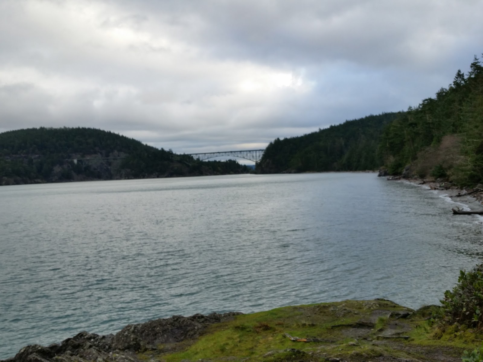
I followed the asphalt pavement to Cornet Bay, enjoying the views of the back side of Deception Pass Bridge.

Cornet Bay and Deception Pass Bridge
After making use of the stellar public restrooms at Cornet Bay, I turned around and headed back.

Closed service road that leads to North Hoypus Point

Oddly, the official PNT marker takes one up into the old growth forest along the CCC Trail instead of going to the end of the point and taking North Hoypus Point Trail. I personally don't understand it because the forest is dark and gloomy with no views and taking the service road all the way down to North Hoypus Point Trail has MUCH better views of the water. The steps saved taking the CCC Trail are nominal at best.

Entrance to the CCC Trail with PNT marker on 2nd post
I wanted views so I went back the way I came. North Hoypus Point Trail eventually met back up with  East Hoypus Point Trail.
Trail to the left is East Hoypus. Trail to the right is I believe Fireside.
PNT marker on East Hoypus Point Trail
The trail back down to Angler's Haven is also flagged with some pink tape. It winds to the left from in front of the sign.
Unsigned trail down to Angler's Haven Road
This hike ended up being about 5 miles round trip. I estimate that all together it was approximately 520 feet elevation gain.

Sunday, December 20, 2015

Goose Rock and Deception Pass State Park

2015 has been a great year for me, although I have not done as much hiking as I usually do. Highlights of the year include visiting Spain in April with my sister, driving to Alaska with my brother, and backpacking to Shi Shi Beach with my cousin. I've had some amazing adventures this year and I have been beyond blessed to have these adventures with family!

Lately my thoughts have wandered to hikes I want to do in 2016. I have come up with a new goal for myself to help motivate me to get back in to shape. I want to hike at least 52,000 feet in elevation this next year. I figure that will be around 1,000 feet each week. It may not sound like much but since I live on an island where the highest point is only 484 feet, it may be a bit of a challenge.

One of the first things I needed to do was to discover a way to find out the elevation of my hikes. I downloaded two different apps onto my phone that should help me with this. One is called Accurate Altimeter. It is free but there is a $1.49 charge if you want to calibrate the pressure sensor. I have not yet made that upgrade but probably will. The other app is called Elevation Profile. It has some interesting features that I not quite figured out completely. I think these two apps have the potential to give me the information I want, once I've figured out how to use them.

After downloading the two apps I was eager to get out the door to try them out. I chose to go to Deception Pass State Park and hike to Goose Rock, the highest point on Whidbey Island at 484 feet. I parked at Cranberry Lake and took the 1.5 mile route up to Goose Rock.
Deception Pass Bridge ahead

The trail was in pretty good shape with only one blow down that I had to crawl under. There were a few places where water was running down the trail but I managed to keep my boots dry.
One blow down to duck under

It was a cloudy day but not raining. I started hiking around 9:30am and didn't encounter any other hikers until I got to Deception Pass Bridge.
Almost to the Bridge. North Beach down below.
I took advantage of the restrooms there at the bridge and then continued under the bridge and up Summit Trail to Goose Rock, following three other hikers I'd encountered in the parking lot. I had pulled out my hiking poles at the Bridge and they came in handy as the trail climbed steeply. I carefully negotiated my way across the slippery wet rocks at the top to enjoy the amazing views.

The west view of the Strait of Juan De Fuca
Then it was time to head back down, and despite my trekking poles I slipped on a wet rock and fell down. Luckily I didn't get hurt at all.
Beneath Deception Pass Bridge
By now it was close to 11:00 and I began to encounter lots more hikers. But for a Saturday there were not as many as I expected. I think the grey skies or perhaps just the need to complete holiday shopping kept people away.

The views on the way down were also stellar in many places. My estimation for the hike was 580 feet total elevation gain.


Tuesday, January 20, 2015

A Beauty Search at Ebey's Landing

It is Martin Luther King, Jr. Day and I am on a beauty search.

At 6:00 am when I take the dog outside it is pouring rain, and even though Sadie politely pees quickly, in two minutes my hair is soaked in the deluge. Hmm, I think. This would be a great morning to try out my new backpacking poncho.

At 7:30 it is just starting to get light and I load my pack, poncho and dog in the car and head to Sunnyside Cemetery to hike the Ebey Landing Bluff. The deluge has stopped and my windshield wipers are on intermittent speed and by the time I park it isn't even raining. Nevertheless, I put on my new rain poncho that I started making before Christmas and have been unable to finish because my sewing machine,which is older than I am and belonged to my mother originally, stopped cooperating. I still need to hem it and sew the pocket on the front. Thus far I have borrowed three other sewing machines, which have also all refused to cooperate with me. Now I wonder if perhaps I should try the poncho and see if there are any final adjustments I need to make. Maybe there is a reason I haven't been able to finish it.

We start hiking to the Jacob Ebey House and I like how I can snug the hood around my head, but I can see that where I planned to put the pocket will be too low and that I will need to move it up at least three inches. I also debate the wisdom of shortening the length as much as I had planned. Right now it is long enough that I wouldn't need my separate rain skirt. I decide that until I have hiked with it more that I will leave the length where it is. I can always shorten it later but it is harder to add length.

By now Sadie has done her business and I am carrying a bag of stinky dog poop. The skies are a light early morning blue and I realize that the rain is not going to happen and when I reach the ocean bluff and see the sandy beach below I decide to go left so I can drop the dog poop in the garbage can at the Ebey parking lot and then do the full beach and bluff loop.

Across the channel I can see the smoke of the Port Townsend paper mill and beyond that the early morning light catches the snow capped tops of the Olympic Mountains. I carefully maneuver down the rain slick wooden stairway that takes me to the parking lot, drop my bag in the garbage and head to the beach. Normally I don't like to walk the beach. I like to stay high for the views and I despise walking on soft sand. But today the sand is rain hardened and mine are the first footprints through it.

I stay on the beach the whole way, gazing in wonder at the glistening Olympics. Then I switch my view to rainwashed rocks littering the beach, enjoying the myriad colors and the gleam of white agates. Sadie pleads with me to let her explore the driftwood piles but we've played this game before and she remains firmly leashed, limited to the 12 foot extension that she runs back and forth on.


Up ahead a white seagull sits on the end of a jutting driftwood log and I snap a picture just before it bounds into flight. Twenty feet off the shore loons bob in the water. I have reached the end of the beach loop and now need to start the switchbacks up to the bluff trail. I pause to give Sadie and myself a drink, and I take off my poncho and coat and stuff them in my backpack. 


I can see a rock cairn on top of the trail marker and I select a small flat stone and leave it on the top as I pass by, building on other people's previous work. To my right a Blue Heron swoops across Perego Lake, wings spread wide and skinny legs dangling behind and I shorten my stride and lean in to the hill as I ascend the first switchback. Below me I can see a jogger on the beach and I suspect that he will probably pass me somewhere on the hill. At the top of the second switchback I pause to allow him to pass. He is much grayer than I and now he will break the trail and that is as it should be.

The ocean spreads out before me, blue ocean meeting blue sky at a point of infinity. A large white ship travels through the shipping channel. Above, an eagle glides past. The sun is tucked tidily behind a cloud but even so, the reflection on the water causes me to squint. My sunglasses and cap are in the car. I was expecting rain.

I round a corner on the bluff trail and the sun breaks out from the cloud and I gasp as the entire hillside shimmers, each individual water drop reflecting the glory of the sun in an Edward Cullen like blaze of iridescence. I pause in wonder for a few moments before continuing on to ascend the final hill. Below to the left I see rows of cabbage growing. 

Another eagle soars past me. It looks smaller than the other eagle. I descend back to the Jacob Ebey House trail and I hear the shrill shriek of the eagle and I search for it in the green fir tops as I walk past tilled fields. I think I see it and then I see that both eagles are sitting side by side on the same tree branch, their white heads shining in the sun. I snap some pictures with my phone.

I no longer have the trail to myself and I tell the people I meet to be sure to look for the eagles. I return to my car, my heart full of beauty.