Search This Blog

Wednesday, May 10, 2017

Baker Lake Adventure

Once again I find myself as a chaperone for the Oak Harbor High School backpacking class. We have a small group this year and as we huddle from the rain in front of the stadium one student never appears and we finally leave without him. We are headed to Baker Lake to Anderson Point. It is a pretty easy 2 mile hike down to a campground by the lake that has bear boxes, fire rings and very rustic toilets. It is a great spot for a first backpacking trip.

When we stop to buy our Northwest Pass we are warned that the creeks are running high due to the thunderstorms yesterday. Brian and I look at each other, thinking about the log bridge over Anderson Creek. It is a slanty single pole log with a rickety cable to hang on to and a tree fell  and cracked it this winter making it even sketchier. Brian and his wife Shelley hiked it last weekend and it was still possible even with the damage.

We head down the trail in a light rain and I am, as always, bringing up the rear. Brian hikes with me, warning the kids to stop at Anderson Creek for us. Before we know it we round the corner and Anderson Creek is roaring before us. The water is running completely over the log bridge, the pole supports with the cables barely above the flow. Shelley and the kids have been looking at a couple logs that might be possible upstream but they are wet, mossy and extremely slippery. A slip would mean a pretty nasty drowning death in the snags downstream and Brian, Shelley and I confer and Brian makes the decision to turn us around. We pause for a snack and a drink of water and we begin the plod back up to the vehicles.

Once again in the back, Brian and I discuss our options and Brian decides we will drive up Baker Lake Road and look for a place to car camp. The kids have already experienced a 4 mile hike with full packs so now we start the hunt for a place to camp. As every campground is closed our hope fades the further up we get. I know that there is an outhouse and a bear proof garbage can at the end of the road but we don't know if we can camp. We are almost there when we see  Brian start to turn the van around. We talk him in to continuing to the end since we are almost there and once we get there he is glad we did. There is spacious room for all our tents and even a picnic table!

We quickly set up our tents in the drizzle and all the kids write down their phone numbers. Shelley and I drive back down to Hwy 20 where we have cell phone coverage and Shelley contacts the parents to let them know our new location. Part of our dilemma is that we only have my little snow peak stove for our group to cook with and we also need more tarps. Brian's tarps and cookstove were stashed at Anderson Point the previous weekend to save space and weight. I call my husband John and ask him to bring up our car camping cook stove, more tarps and some dry firewood, but his truck isn't running well and he isn't sure if he will be able to borrow a car, so Shelley and I decide to go into Concrete to see what we can buy. We see a large fluorescent sign advertising a yard sale and swing by. We score a huge 20x20 tarp for ten bucks and the lady also agrees we can fill up out trunk with her uncovered wet firewood for five more dollars. She also gives us three large dry pieces of cedar for kindling!

Next stop is the hardware store on Main Street where we buy a bundle of dry firewood and the clerk generously gives us a large cardboard box of dry wood pieces and some paper for starting the fire.

Shelley eats gluten free but has never heard of 5B Bakery so of course I have to stop to introduce her. After scoring a strawberry rhubarb hand pie and a blueberry muffin we continue to Outdoor Ventures and purchase two large fuel canisters for my camp stove. 

We head back up to the camp where German exchange student Greta organizes all of us to hang up the tarps. While we were gone they managed to start a smokey fire but the addition of our dry wood helps kick things up. As we are huddled around the fire a car drives up and my husband jumps out. He and our friend Mike have brought us more firewood, camp kettles for heating water, tarps and camp chairs. But when they go to set up the camp stove for cooking they realize it doesn't have all the parts and when they head back out an hour later they take it with them. We will be using my little snow peak stove and the fire to heat water and cook for the weekend.

It is starting to get dark and I crawl in my tent and snuggle into my sleeping bag. I wake up cold around 2:00 am and realize I need more air in my sleeping pad so I roll off and blow more air until it is quite firm, but that helps and I fall back to sleep, finally warm as long as I keep my stocking hat on. I roll out of bed around 7 and teach the young man who is up, Dylan, how to get the fire going. He's been up since 5:30 and will start the fire tomorrow. We start heating up water and eventually more kids get up and join us and start cooking their breakfasts. Some had been cold during the night but all had stayed dry with the tarps over their tents.

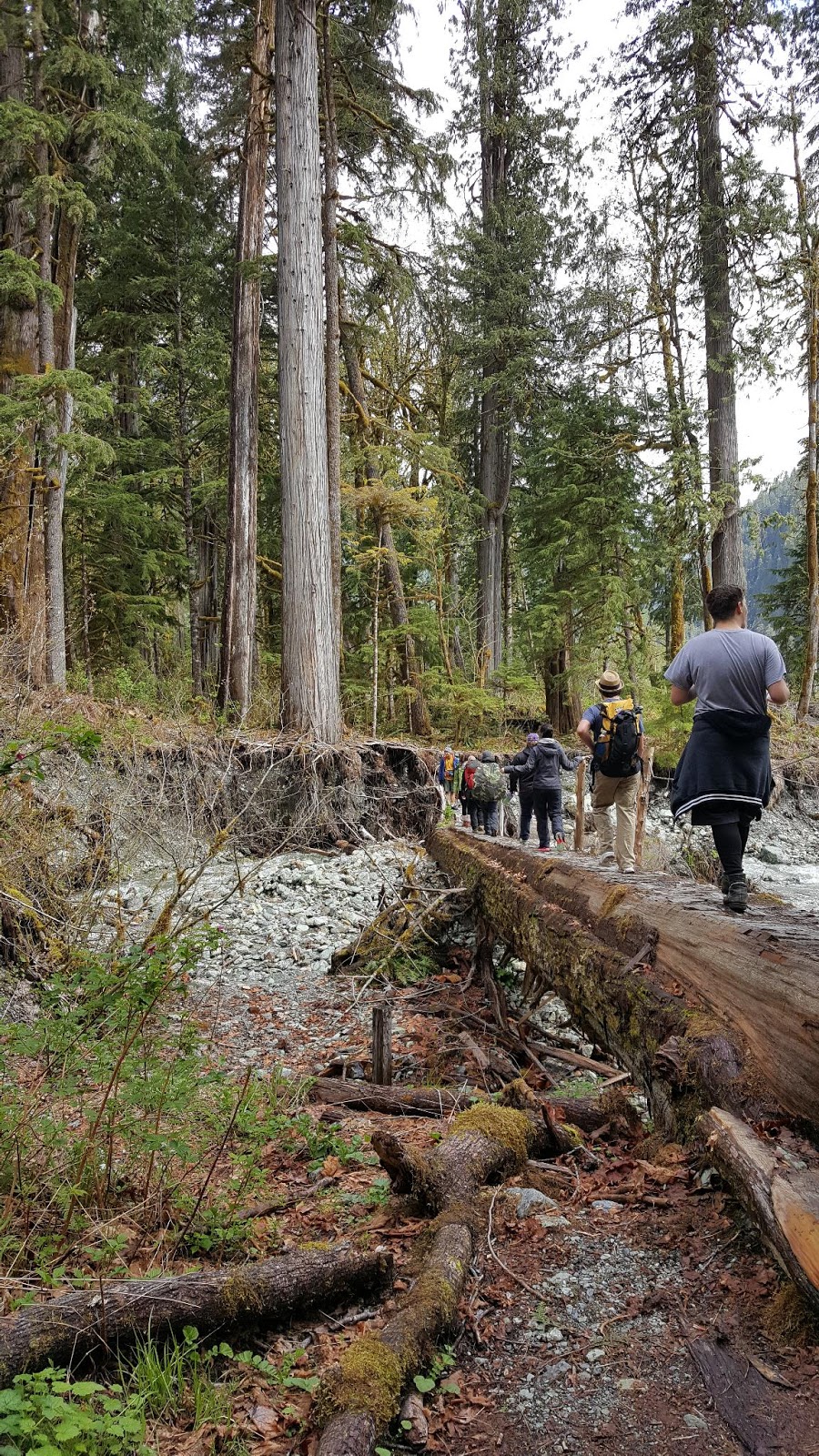
After breakfast we head up the river to the foot bridge over Baker River where we take pictures just as it starts to sprinkle. We head up the Baker River Trail and once again I am bring up the rear. We cross several little streams and the kids always wait to help me across and I manage to keep my feet dry. Eventually we get to a large stream where there was a log bridge that is now washed out. Once we get to the end of the bridge we clamor down and scout out another log to cross the rest of the way. It is dry and we carefully walk across although Brian elects to crawl. Once we are safe on the other side we continue hiking until we reach Sulphide Creek and the end of the trail where we stop on the banks and eat our lunches. It starts to sprinkle again as we turn around to go back and by the time we reach the washout the log is wet and slippery and this time I crawl across it, too.

When we get back to camp we stoke up the fire and play a game of Apples and Oranges before cooking up our dinners and making smores. It is supposed to be even colder tonight, down to about 35 degrees and I take all the hand warmers out of my car and give them to the kids to help them stay warm during the night. I snuggle into my tent again. It is another cold night and I sleep a bit cold but Dylan has the fire going when I wake up and a hot cup of coffee helps. After breakfast we pack up and then scour the area, picking up all trash and broken glass from previous campers before walking down to the river to take a picture. The sun is out and it is warm.

We have a little extra time and so we stop at Baker Hot Springs on the way out so the kids can see a natural hot spring. A final stop at Five Guy's Burgers for lunch and we are back to the school by 2:00. It was a great weekend!


Monday, February 6, 2017

PNT Alternates on Whidbey Island

As hikers of the Pacific Northwest Trail traverse Whidbey Island on their way to the Coupeville Ferry, the official route from Joseph Whidbey State Park is a beach walk down the west side of the island. This is a lovely walk, but should be done on a tide of 4 or lower since there are several areas where the tide can push you up against the cliffs or even cause you to have to be in the water. The best walk is on an outgoing tide so any sandy sections are on wet firm sand. The beaches on Whidbey change with every tide. Sometimes there are sandy parts but often it is mostly pebbly rocky sections.

Fortunately there are several places where you can jump off the beach and take an alternate route if the tide is not accommodating. Hastie Lake Road, Libbey Road, Fort Ebey State Park, Ebey's Landing and Fort Casey are the five places where this can be done.

From Hastie Lake Road take West Beach Road south to Libbey Road. Turn west on Libbey and you can either rejoin the beach walk if the tide permits, or take the alternate through Fort Ebey State Park.  To take the alternate turn south on Fort Ebey Road. You will go up through a residential neighborhood to the old entrance to the fort which looks like a private driveway. 

Take that and look for the trail on the left which leads you into the park. Stay on the trail/old road until you reach an actual asphalt road. Follow it to the right (west)  and go about a hundred yards and take the first trail on the left which goes to the Bluff Trail. You can also catch the Bluff Trail if you've been on the beach. From the beach you can see the trail go up into Fort Ebey State Park. If you are at all concerned about tide, this would be where you want to get off the beach because Partridge Point is coming up and is one of the places that is impassible on a higher tide. Follow the Bluff Trail south past the old fort battery and campground. From the campground take Kettles Trail which eventually pops you out next to Highway 20 and becomes a paved bike path.

Continue south until you reach the Kettles Spur to Pratt Loop Trail. Take that to Ebey Prairie Trail to Ebey Bluff Trail and back down to the beach at Ebey's Landing.

From here, decide if you will take the beach or an alternate route. To take the alternate head south up Hill Road. To your left you will see a ravine with a weathered gray house at the top. This is the old Ferry House (now owned by the National Parks) which was run by the sons of Isaac Ebey after he was murdered and beheaded by Indians in a retaliation killing in 1862. After his murder his home was abandoned and eventually torn down and the lumber was used to build the Ferry House which lodged travelers coming onto the island from Port Townsend and enabled his orphaned boys to make a living.

Continue up Hill Road past a 75 year old red barn with curious cows until you reach Engle Road. Turn right on Engle and follow that until you see the signs for the Admiralty Inlet Preserve trails.

Admiralty Inlet Preserve is a cool hiking area and preserve of one of the few remaining wild prairie on Whidbey Island. You have a couple choices here. If you are in a hurry to catch the ferry take the path that parallels Engle Road. But the better choice is the bluff trail which is a mere 1/10 mile longer but has great views of the water and Olympics and takes you down grassy paths through corridors of wild roses. When you get to the place where it looks like a driveway goes to the left, take that back down towards Engle Road. But before you do that, take a look at the views along the bluff to your right. There is a placard which identifies the mountain peaks of the Olympics across the Sound and anoth which tells some of the military history on Whidbey.

Once the pathway rejoins Engle Road near Fort Casey, follow the road to the Coupeville Ferry. If you have the time and like old military forts, wander up to Fort Casey. Several parts of this fort have been repainted recently and a couple big guns are still installed. There is also the old Admiralty Head Lighthouse that you can climb up into during visiting hours.

If you want a snack while waiting for the ferry be sure to visit the Keystone Cafe. Friendly staff, good sandwiches, cold ice cream and a cozy outside deck make this a great little stop.


Sunday, September 25, 2016

August 16, 2016 hike of Chain Lakes at Mt. Baker

With summer rapidly coming to a close, I decided to take a day and go up to Mount Baker to hike the Chain Lakes Loop. I wish I would have thought to check the Department of Transportation website before I went because I was not expecting the road construction which delayed me almost an hour. I pulled into the parking lot at Artist Point around 9:00 am, strapped on my pack and adjusted my hiking poles. I'd decided to hike the loop counterclockwise, thinking that I would get the steep downhill done while my legs were still fresh and have an easier time at the end of the hike. I came to regret that decision because it was insanely steep and I was terrified to falling, even with my hiking poles. It would have been better for me to hike up it than down, and if I ever do this hike again I will park at Austin Pass/Heather Meadows, hike clockwise up Wild Goose Trail and do the loop that way.

Selfie at the start  
Headed out from Artist Point to Wild Goose Trail


Terrifying descent on Wild Goose Trail, even with my hiking poles.

Bagley Lake below and I can see the trail I'll take up Herman Mountain


Once I got down to Austin Pass/Heather Meadows, I wandered into the little informational building for awhile before continuing on down to Bagley Lakes. My legs were quivering with the effort I had put into the Wild Goose Trail descent and I needed a little break.

Upper Bagley Lake was a great spot to sit and have lunch, and I soaked my feet in the cold lake while I ate. There is cool stone bridge across the lake.
Nice lunch spot

View down to Lower Bagley Lake

The Mountains are Calling

Climbing up Herman Mountain
From Bagley Lakes the long ascent up Herman Mountain began. It was surprising hot out and there was very little shade. Fortunately there were several places where little streams crossed the trail and I took advantage of them to soak my hat, hair and even my shirt. The trail was rocky and hard on the feet and I found myself seriously wondering if I was capable of finishing this hike.
I can see Mt. Baker ahead! I must be close to the top, right?

Looking back at where I came from and Mt. Shuksan

Yes, I am at the top of the 5,400 Herman Saddle, with Mt. Baker to the left. The red face says it all!
There were quite a few people at the top of Herman Saddle and I paused to take a few pictures before heading down the other side. A couple hikers warned me of a brief snowy section ahead where it was easy to lose the trail so I followed their advice and crossed it in a C pattern.
Mt. Baker

Iceburg Lake ahead

A bit of snow helps to cool me down
The trail descended down to Hayes and Iceberg Lakes and the beauty of these lakes was wonderful.
Hayes Lake

Beautiful meadows

I passed Hayes Lake on my right and continued past Iceberg Lake on my left. I tried to stop at Iceberg Lake for awhile to soak my feet but the mosquitoes were voracious and quickly chased me back to the trail. I did eventually get to a lovely little stream that crossed the trail by a big rock and stopped there for awhile to filter some more water to drink and cool my feet. I continued past the Mazama Lakes and then it was time for another ascent.
Time to head up again

Wildflowers!

Oh the views of Mt. Baker!

Resting in a spot of shade before the final push
By the time I got to this spot, I was pretty exhausted. I rested in the shade until I felt I had some strength back, sipped some water and munched on some dried fruit. The last part of the trail was rocky with no shade and I was actually so tired that even the amazing views almost weren't worth the pain I was in.

Finally I reached the top, crossed the ridge and began the traverse on the other side. Below I could see Swift Creek and Rainbow Valley and even a bit of Baker Lake. Another hiker pointed out some mountain goats.

Mt. Shuksan

Mt. Shuksan


Baker Lake in the distance
The last mile had amazing views and I'd like to do this part again when I'm not so tired. I think I would appreciate this more if I wasn't so exhausted. Finally, I reached the parking lot, flopped my backpack in the back of my car and collapsed into the driver's seat, cranking on the air conditioning full blast. The drive home was uneventful except for getting stopped in the construction again. The hike was an 8 mile loop with a 1,700 foot elevation gain.


Sunday, August 28, 2016

Naches Peak Loop Trail at Chinook Pass

Unlike previous years, this summer has been a quiet one at home. My dog, Sadie, has slowed down a lot this past year and has a hard time going beyond about a 2 mile hike. She also needs to be let outside more frequently, which means that I've needed to stay home to take care of her more, or potentially suffer the consequences by cleaning up a big mess.

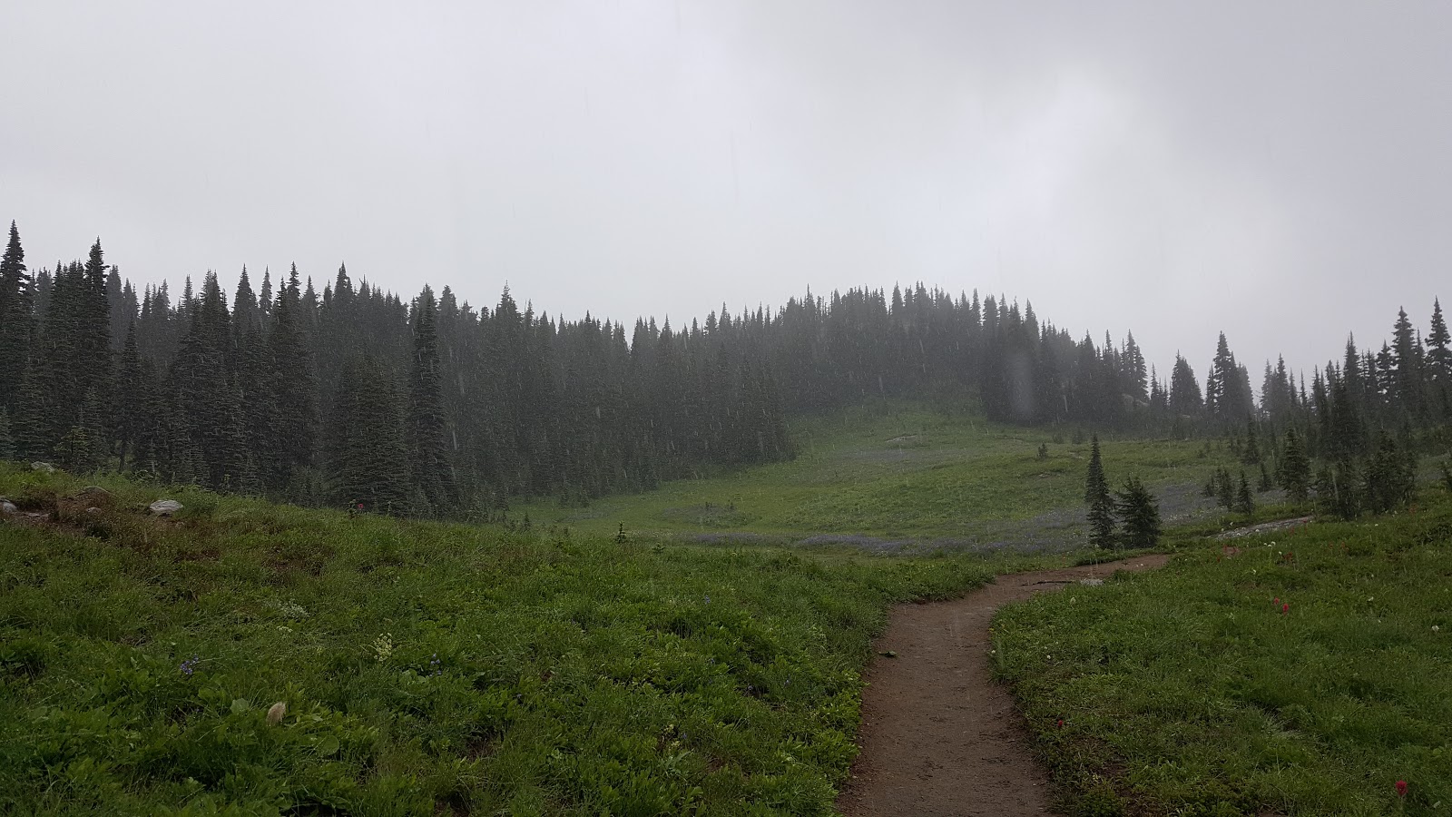
However, I decided to risk a one day trip to Yakima to pick up some venison and steelhead a friend had offered me because she wanted to get her freezer cleaned out. I plotted a course over Chinook Pass and stopped at the top to hike the Naches Loop Trail. Unfortunately, it was a rainy day and so the mountain views were not stellar, but the wildflowers were out in all their glory and I was simply grateful to have the chance to do this hike. The lack of views just gives me a good excuse to come back and do the hike again!

I parked in the parking lot by Lake Tipsoo, pulled on my rain coat and settled my backpack on my shoulders.


The trail wandered past Tipsoo Lake and then crossed Hwy 410 where it began to climb steeply. The trail showed recent signs of work with good ditching.
Wildflowers of lupine and Indian Paintbrush lined the pathway and I attempted to take in their beauty while simultaneously watching my footing.
The trail connected with the Pacific Crest Trail that goes down to Dewey Lake. Three years ago I climbed up from the PCT/Dewey Lake in a driving rain shower punctuated by occasional snow. I was happy to skip the snow this time, but it did seem sad that I was once again hiking it in the rain. This time I enjoyed it much more with proper rain gear.


Once I was on the eastern side of the loop the clouds broke a bit and I could see some of the mountains.
Eventually the trail crossed over Hwy 410 again and I took the spur back to Lake Tipsoo. This was about a 3.2 mile 600 foot elevation gain hike.

Thunder Knob

On July 9, Marissa and I headed up to hike Thunder Knob. It had been on my list for awhile and I was excited to have a friend from work to hike with. We drove several hours up to the trail head which was right off Hwy 20.

The forecast was for rain but luckily it held off for almost the entire hike. The hike started at a campground and went along a creek that looked like it had washed out parts of the campground at some point in time. I could see a picnic table in the creek bed.

 We continued up about a 650 foot elevation climb, admiring the mountains that surrounded us.


We paused to admire a pretty little pond with a nice bench before continuing on. We crossed over the top and below us Diablo Lake shimmered in all its green glory. The eerie green is caused by glacial run off.


We climbed down to sit on a little rock outcropping and enjoyed the views while eating our snacks. Finally it was time to return and we headed back down to the car.

This was a nice little hike, about 650 feet elevation and around 3.6 miles.


Friday, March 25, 2016

Trail Maintenace and Construction on the Tursi Trail

It has been awhile since my last trail maintenance with WTA so I signed up to work on the John Tursi Trail in March. We met Saturday morning at Sharpe Montgomery Park on Fidalgo and then car pooled to the end of Ginette Road, passing through the gate for authorized vehicles only and parking on top of the cement slab of a former home. I stood on top of that slab a few weeks earlier when I had hiked the Tursi Trail. Now I am back to make my own contribution to the trail.

We are a diverse group of old and young. The youngest is around seven and this is his 10th trail maintenance project. He goes with his grandma who has done more than 50 projects.

The goal for the day is to level tread and spread dirt on the path. Several large rocks are moved to build retaining walls. I spend most of the day hauling buckets of dirt, spreading it out and tamping it down.


A barrow pit provides the dirt. A sling system slides the buckets of dirt down to the trail where they are detached and I haul and dump them.

At 2:30 we hike a mile to our cars, carrying tools and empty buckets.  I am tired and a bit sore but the satisfaction I feel at seeing my beautiful section of trail is immense. There is another trail maintenance party in April and I will probably be back to help again. There is still a lot of trail to be built before the trail will be opened.


Thursday, March 3, 2016

Tursi Trail

Mystic rocks, a dilapidated old log cabin and an abandoned mine shaft. These are some of the unexpected treats along the new trail being built to connect the Anacortes Community Forest Lands with Deception Pass State Park.  For hikers on the National Scenic Pacific Northwest Trail this new extension means a little less road walking on Fidalgo Island.

The trail is named after 90 year old John Tursi who worked as a CCC worker at Deception Pass during the 1930s and has been an influential community member in Anacortes. Skagit County and Washington State officials have been working to secure easements from private land owners along the route for over five years and construction began this winter.

Last Saturday I loaded up the dog and drove to Pass Lake by Deception Pass to check out the work being done. I strapped on my day pack and headed up Pass Lake Loop Trail. Below me I could see glimpses of lake water sparkling through the trees. Despite the record setting rains of the previous week the trail was in pretty good shape, although there were a few places where water was flowing down the trail.

From Pass Lake Loop I took Ginette Trail and dropped down into Naked Man Valley. I passed fantastical rocks as the trail meandered through ferns and skunk cabbage. I skirted carefully over and around a tree that had fallen, the the upturned root ball wiping out a section of trail. But it was obvious trail maintenance had been performed recently as blow downs were neatly cut up and off the trail and foliage was cut back.

After squishing around a giant mud puddle I began the ascent up Ginette Hill, popping out at an amazing view point where a concrete slab foundation and a pile of old wood are all that remain of some family's previous home. I stood and gazed out towards Mt. Erie and Campbell Lake, enjoying the rewarding view after that ascent. Eventually we continued along the path.

Campbell lake in the distance
I continued my walk through the woods, taking note of various side trails that l could take to see over the ridge I was hiking along. I passed an old quarry with a fire ring where people have apparently camped before, rounded a corner and saw the entrance to an old mine shaft. I was tempted to explore but didn't have a powerful headlamp and the entrance was full of water, so I continued on my way. 

An old mine shaft from the 1940s. I was told that  they mined some substance that they used in lipstick!

The trail was now flagged with tape and I could see where new trail had been cut in. Eventually I got down to where the trail work had ended and although I could tell from the flags where the trail was to go, I didn't want to bushwhacked my way through the thick brush so I turned around.

As I returned I noticed an old log cabin that I had somehow missed on the way up. The roof was missing but all four walls were still intact. I explored around it for awhile before continuing on my way. 
 
Four walls are all that remain of this log cabin


On the way back out I had the fortune to encounter another couple who were hiking with their dog and we stopped to chat. The man worked for Skagit County Parks and had been instrumental in getting the landowner agreements to create this trail! They were both very nice and told me about the craggy rock face across the valley, called the Morris Graves Rock, after the famous mystic painter Morris Graves.
 
Morris Graves Rock across the valley
Morris Graves bought a piece of property up at the top of the bluff above Campbell Lake at a tax sale in the 1930s for $40. He built himself a rustic cabin with no electricity or water and painted some of his darkest paintings while he lived there. He was one of four painters of the Pacific Northwest School of Art, and he painted according to what he saw with his inner eye, versus in an abstract form or realistic form. Eventually he left and moved to California and the cabin was given to one of his long time companions, who sold it to another artist. This man lived in the cabin for several years. He suffered from Lou Gerhigs disease and unfortunately, in 2001 was caught in a fire which completely destroyed the cabin and killed him. 

Campbell Lake below with the Morris Graves Bluff and Rock in the left center. Tursi Trail winds through the trees on the right side of the lake over to Pass Lake.

After returning to my car, I drove up to the top of Mt. Erie to take a picture of Campbell Lake, Morris Graves Rock and to see if I could see any of the trail, which I couldn't. I highly recommend this delightful trail. There is another work party mid March which will hopefully complete the trail so it is ready to open officially by spring and summer.