On Saturday, July 27th, my cousin Kelley and I started our PCT hike through the Mt. Jefferson Wilderness. I hesitate to call it epic, which seems to be an overdone word in the hiker world, but if it isn't considered epic, I don't know what else it could be called. It was literally a life changing event for me. We spent most of the morning driving the rough and bumpy roads up to Olallie Lake to drop off Kelley's smart car. Then her husband Adam took us down to Santiam Pass and we began our hike around noon.

I was not expecting the eerie fire scarred scenery at Santiam Pass. Although a friend of mine told me she'd had to skip this section in 2003 due to a fire, all I'd ever heard about was the "green tunnel" of Oregon. Ten years after the fire, new growth has started, but the first twelve or so miles were all through the burned section. The trail started off nice and well maintained at 4,847 feet elevation. We steadily hiked up, carrying a heavy load of water since there would not be any water source until we reached Koko Lake ten miles in and not knowing how much water we'd be going through, we were each carrying about 4 liters. By the end of the trip I realized that I go through about 2-3 liters of water a day hiking, depending on the steepness and heat.


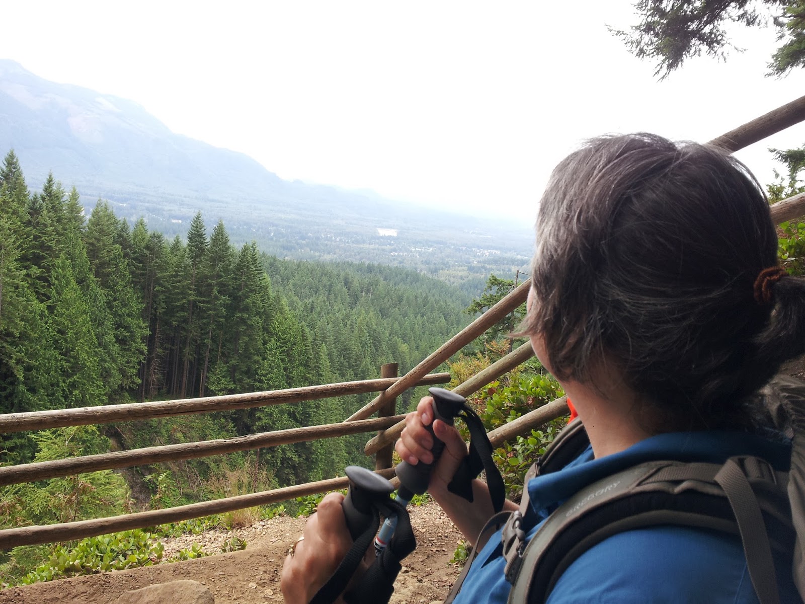
Kelley set the pace for us most of the time. She hadn't hiked as much as I had and so I had her lead, figuring we'd go at her pace. Her pace actually ended up being about perfect. One thing we discovered is that we're both short, only about five feet tall, and we definitely have our grandfather's short little legs. It made it ideal for us to hike the same pace, but was definitely a disadvantage when it came to stepping over downed trees or trying to hop rocks across steams.
Occasionally we'd stop for a breather since the altitude tended to wind us at times.
Off to the west was a beautiful cylindrical volcano mountain. We never did figure out what it was called. In the picture above the grey areas are where the fire burned through. It was very interesting to see where the fire skipped over areas and burned through other areas.
Above was the view behind us. We'd occasionally turn around to see the view of the Three Sisters, Hayrick Butte and Hoodoo Butte. Before us was the rugged beauty of Three Fingered Jack.
Here we began to see our first views of Mt. Jefferson, which we would hike to the other side of by the 5th day.
Eventually we hit our first snow field and encountered our first major trail challenge. We followed the footprints down the snow field and then lost the trail.
Eventually I pulled out my cell phone and turned on the gps and used the Halfmile app to try to figure out where we were in relation to the trail. I expected that I'd have a little map on the phone that would show me, but it merely gave us our coordinates. Then I pulled out my compass and used the compass and the coordinates to point us toward the trail. The problem with this is that although we were going in the right direction, we didn't know what elevation we should be at. We took a little break, had a bite to eat, and decided to go back to where we'd lost the trail at the snow bank. As we were traveling back up to the snow field, I looked up and could see the trail on the ridge above us, so we scrambled up and met the trail again. What a sense of accomplishment we felt at finding the trail again and keeping our heads!

Shortly after this we met three southbound through hikers who were kind enough to stop and chat with us for a minute. It was a couple named Rachel and Benny and another young man whose name escapes me. They are keeping a blog at
http://rachelandbennyhikethepct.blogspot.com which is well worth checking out. We were almost to the top of Three Fingered Jack and when we crested the ridge a photographer popped out to greet us! He was camping up there waiting to take dusk and dawn pictures of the purple lupine in bloom far below in Canyon Creek Meadows. It seemed a windy and cold place to camp, but obtaining the "magic light" made it worth it for him.


We descended the other side of Three Fingered Jack on a series of long switchbacks and noticed that the trail was no longer as well maintained. Downed trees littered the trail and the sun sunk further in the sky as we tried to make it to our first planned camping spot at Lake Wasco. I began to realize that we were hiking through a forest of widow maker trees and was very grateful that it wasn't windy. I would have been terrified if I'd been hiking this section in the wind. Around 9:00 pm we arrived at Lake Koko,(elevation 5,440 feet at PCT mile 2017.8) not our original destination, but we were exhausted and it was starting to get dark so we put on our headlamps and set up our tents as far away from the dead trees as possible, while avoiding the marshy wetness of the lake. I was still so keyed up from the events of the day that I had a hard time going to sleep, especially after I heard what sounded like elk going past our tents. In the morning I heard the same noise when I saw two deer go past so I believe it was probably actually deer. They were just much louder than I expected!


I found myself a couple nice rocks. One was nice and level for my Snowpeak camp stove and a larger one made a great meditation rock as I gazed back up at Three Fingered Jack, marveling at the distance we'd already come while I waited for the water to heat up for my oatmeal. We packed up and hit the trail about 9:00 am. Day two's destination was Shale Lake, a distance of about 12.5 miles. The trail remained in poor condition, with many downed trees to negotiate around or over, and many areas where the trail acted as a stream bed down the hill, leaving the trail rocky and pitted.

We stopped at a view point and realized that the lake far below us was our original 1st night destination, Wasco Lake. Kelley and I both agreed that it was a blessing in disguise that we stopped at Koko Lake instead, skipping the three hundred foot elevation change. Along the trail we ended up leap frogging with two other sets of hikers for the first three days. One set, both guys, we called the ZZ Top guys since one of them had a long, meticulously groomed beard. The other set, both girls, were called Jessie and Linda. They were beautiful, long legged former roller derby girls. All of them had camped at Wasco Lake and said that it'd been noisy with a family that was hogging most of the good camping area. Except for the deer, our night was quiet, and we were the only ones camped there.


Above, Indian Paintbrush. We reached Rockpile Lake (elev. 6280 ft at PCT mile 2022.2) around noon and this was the first place we tried to get water. Kelley was carrying a filter, but we couldn't get it to work. It just wouldn't suck the water up. Fortunately, I had my steripen as well, so we figured out a way to dip the water into my bottle so I could use the steripen. It took us awhile to figure it out. Both the Roller girls and the ZZ Top boys were at the lake when we arrived and they left before we were done. A northbound thru hiker named Charlie came through and chatted with us awhile. His lips were terribly sunburned, as ours would be too, by the end of our five days. We observed with interest the solar panel that he had attached to the top of his pack that he used to keep his ipods, cell phone and extra batteries for his head lamp charged. I kept my cell phone on airplane mode and turned off at night to conserve the battery and it lasted until the end of the 4th day. Kelley forgot to do the same and it was dead on day two. We both agreed it would be lovely to have some way to recharge our cell phones.

From Rockpile Lake we started an amazing ridge walk. We were so high up and on such steep slopes that we had to stop to be able to enjoy the views. At one point we had views 360 degrees as we walked a narrow ridge top.


We pulled in to Shale Lake (elevation 5873 ft, PCT mile 2030.3) around 7:00 pm and hiked to the far side of the lake, setting up our campsite fairly close to the ZZ Top guys. By the time we heated water for our freezer bag meals, put up our tents, blew up our air mattesses and ate dinner, we were ready for bed. The mosquitos were out in full force so we changed into our long underwear. I wanted to keep my rain fly off to enjoy the night sky, but worried about the condensation. Turns out that it was good I used it because everything was soaked when we woke up, even though the night sky and stars were stellar when I stumbled out of the tent at 1:00 am to pee. We broke camp about 8:30 am after our tents had dried out and headed out. Day three's destination was Jefferson Park.
We started off day three with an elevation loss of 500 feet on a long series of switchbacks through shady evergreen trees. Kelley and I passed the time catching up on all our family history for the past 30 years and discussing topics from spiritual beliefs, to the BRCA 2 gene, to the secret code of colored bandanas of the gay community. Kelley has led a very interesting and colorful life. She's been a stand up comedian, a waitress, and a CBS radio news producer. If you were listening to CBS radio on 9/11 you were probably listening to her live feed as she reported her observations nationwide from a phone booth 15 blocks from the twin towers.
This stream looks tiny in these pictures but was actually probably eight feet across. Just wide enough to be a problem.
Eventually we reached our first glacial stream ford of Milk Creek at PCT mile 2035.3. The ZZ Top guys were there and gave us some advice about crossing it. We watched them hop their way across on large boulders, but when we looked at it, we decided our short legs weren't up to the task and scouted downstream for a suitable place to ford, taking off our boots and socks and pulling on our river shoes. We both had our first blisters that morning, and spent some time after we crossed doctoring with moleskin. Then it was uphill again.
We stopped for lunch at the Woodpecker Trail sign, plopping ourselves down on logs and rocks. Jessie and Linda, the roller derby girls, joined us for a break, and Kelley told them about her trail name, Bushel Baby. When Kelley would take her mom to chemo treatments they would listen to books on tape in the car on the hour drive. The last book they listened to together was
Wild, by Cheryl Strayed, about her adventures on the Pacific Crest Trail. When I sent out my Facebook request for someone to hike the PCT with me and tagged her in it, she decided to join me in honor of her mother. She chose the name Bushel Baby because she and her mom would always say, "I love you a bushel," and Kelley would reply, "No, I love you 10 bushels." Aunt Judy would say, "No, I love you 20 bushels!" After her death Kelley would see bushels in the most random unexpected places and knew it was her mom telling her that she loved her.
We got better at finding rocks and logs to sit on when taking a break. This was probably one of our harder days, with not a lot of views and bushy, overgrown trails.
The above picture was one of the few views of the day. Eventually we reached the dreaded Russell Creek, elevation 5488 at PCT mile 2039.5. On the PCT Halfmile map notes it describes Russell Creek as "milky glacial water, can be a dangerous crossing." The backpacking book I'd consulted said it was best to cross early morning when the level was at the lowest, and avoid afternoon crossings. It was about 3:00 pm when we reached it, and it was a fast moving creek in a narrow canyon. I again scouted us out a place to cross, using my years of river experience from growing up with a river in my back yard. Sometimes I take the skills that I have for granted, assuming that everyone knows how to read a river, where the fast parts are, the deep parts are, etc. That simply isn't the case.
I found a place where the stream broke into three parts so the force of the water would be less and where there were no deep holes. With the aid of our trekking poles for stability, we both made it safely across.
Crossing Russell Creek felt like a huge accomplishment because I'd been rather worried about it based on the guidebook descriptions. I suspect the early warm July weather may have made it a little less treacherous than normal, but for us short legged gals, it was a big deal! We clapped high fives, doctored up our feet again, and began a steep climb up to Jefferson Park where we would need to find a designated campsite to camp in.
Mt. Jefferson behind a meadow of wild flowers.
Above: Kelley smooches a dragon tree. Below: the beautiful alpine meadows of Jefferson Park.
As luck would have it, we were able to find a designated camp site not too far off the trail and we set up our tents, boiled water for dinner, and got water from Scout Lake. My steripen was being finicky and it took multiple tries to treat the water. I may take it back and go with something like a Sawyer Squeeze filter instead. We collapsed in our tents about 8:30 pm and called it a night. The next morning we again had to dry off our tents before we packed up, so we got out of camp about 8:30 am. The morning began with a steep climb up to Park Ridge. The views were amazing! Mt. Jefferson was close enough to almost touch.
After several hours of huffing and puffing, we reached the top at over 7,010 feet elevation, leaving the Deschutes National Forest and entering the Mt. Hood National Forest.
A colorful windsock marked the top of the peak. Luckily another hiker was there and took pictures of me and Kelley and we returned the favor and took pictures of him and his daughter. Below: Mt. Jefferson behind us on the south side of the ridge.
Mt. Hood in the distance on the north side of the ridge.
We stopped and ate lunch on the top facing Mt. Jefferson, enjoying the amazing views and our sense of accomplishment for conquering that climb.
After lunch it was time to begin our descent on the north side by traversing a large snow field. We slowly picked our way across, again using our trekking poles to keep us from sliding.
This was probably my favorite day of the entire trip. The views were amazing and the sense of accomplishment on top of the mountain was indescribable. The trip down crossed lots of rocky trail, broken up by alpine meadows and small alpine and glacial lakes. We stopped at one to get some water.
Eventually we made it back down and entered another burned section. But this was obviously a much more recent burn. The trees still had their blackened bark on them and the smell of ash lingered. The views continued to be fabulous past Pyramid Butte, although all the rock and talus we walked on in the afternoon was very hard on the feet.

By 3:00 pm I was hot and tired and when I saw the sign for Breitenbush Campground I talked Kelley into going to see if we could stay there for the night. I wanted to swim in Breitenbush Lake and get cleaned up a bit. But unfortunately, when we walked 3/10 of a mile to the campground, to our dismay signs were posted saying no swimming or bathing in the lake! It was a rather ugly, marshy lake anyways, and was on the Cold Springs Indian Reservation. We plopped on a picnic table, ate down a bit of weight from our packs, aired out our feet, and then eventually shouldered our packs again and walked back to the trail to hike the additional 4 miles to Upper Lake, elevation 5389 at PCT mile 2051.2. Upper Lake ended up being a nice place to camp and we set our tents up mere yards away from the water. The mosquitos were voracious, but a light breeze kept them away long enough for us to watch a lovely little pink sunset. By this time my cell phone had finally died so I was unable to take any pictures. On Day five we got up, packed up, and made our way down to Olallie Lake. We stopped in the Olallie Lake Resort and purchased capri suns and water, and signed the PCT register. I charged my phone in the car long enough to be able to snap a final victory picture of us at Olallie Lake with Mt. Jefferson in the background!

This trip filled up my soul in a way that is difficult to describe. I loved sharing the experiences with my cousin Kelley, overcoming obstacles of getting lost, high altitude, creek fords, and snow fields. The people we met along the way were amazingly nice, the views stellar. Alright, who's in for another? I think I have found my new addiction!


 I
I