Search This Blog

Wednesday, December 30, 2015

North and East Hoypus Point Trails

I've downloaded yet another app to help me with my hiking. It is called Map My Hike and I tried it out today on part of the Pacific Northwest Trail that goes around Hoypus Point on Whidbey Island. So far it gets two thumbs up!

I parked down on Angler's Haven Drive and took the trail up to Hoypus Point. There used to be a wooden sign that said PNT on this trail but some one has removed it, so the trail, although obvious if looked for, is no longer marked. It is the trail that starts to the left of a metal gate with a No Hunting sign.

PNT goes on the trail to the left of this metal gate

The trail lead steeply up hill and eventually popped out at the East Hoypus Point Trail with this sign directly in front.

I took the trail to the right (north) and followed that around to where it turned in to North Hoypus Point Trail. The trail was in okay condition with a few blow downs and I had to skirt at least three large mud holes. Wearing boots was a good choice. Eventually the trail came down to the old service road for Hoypus Point where a couple picnic tables sat forlornly. The service road ends down at the beach but that section was washed out in 2007 and has been closed to vehicles ever since.


Trail to the left goes down to the beach. Trail to the right is North Hoypus Point Trail.
The trail down to the beach is worth a side trip if you've never visited this area. It leads down several hundred yards to where the old ferry would pick up and drop off passengers before Deception Pass Bridge was built. There was a large metal saw blade attached to a post that passengers would pound on when they wanted a ride. The ferry captain, who happened to be a woman, lived on the other side of the water on Fidalgo Island. When she heard the gong sound she'd come over and pick up the people.

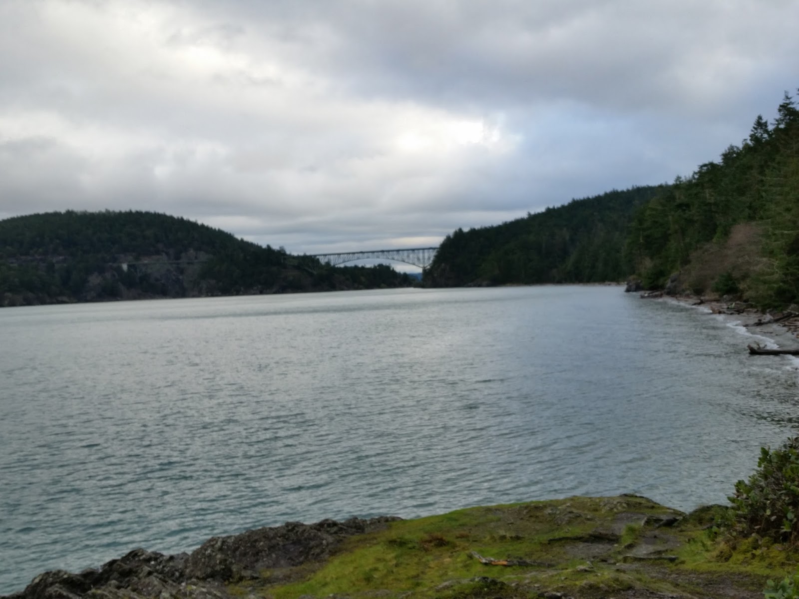
I followed the asphalt pavement to Cornet Bay, enjoying the views of the back side of Deception Pass Bridge.

Cornet Bay and Deception Pass Bridge
After making use of the stellar public restrooms at Cornet Bay, I turned around and headed back.

Closed service road that leads to North Hoypus Point

Oddly, the official PNT marker takes one up into the old growth forest along the CCC Trail instead of going to the end of the point and taking North Hoypus Point Trail. I personally don't understand it because the forest is dark and gloomy with no views and taking the service road all the way down to North Hoypus Point Trail has MUCH better views of the water. The steps saved taking the CCC Trail are nominal at best.

Entrance to the CCC Trail with PNT marker on 2nd post
I wanted views so I went back the way I came. North Hoypus Point Trail eventually met back up with  East Hoypus Point Trail.
Trail to the left is East Hoypus. Trail to the right is I believe Fireside.
PNT marker on East Hoypus Point Trail
The trail back down to Angler's Haven is also flagged with some pink tape. It winds to the left from in front of the sign.
Unsigned trail down to Angler's Haven Road
This hike ended up being about 5 miles round trip. I estimate that all together it was approximately 520 feet elevation gain.

Sunday, December 20, 2015

Goose Rock and Deception Pass State Park

2015 has been a great year for me, although I have not done as much hiking as I usually do. Highlights of the year include visiting Spain in April with my sister, driving to Alaska with my brother, and backpacking to Shi Shi Beach with my cousin. I've had some amazing adventures this year and I have been beyond blessed to have these adventures with family!

Lately my thoughts have wandered to hikes I want to do in 2016. I have come up with a new goal for myself to help motivate me to get back in to shape. I want to hike at least 52,000 feet in elevation this next year. I figure that will be around 1,000 feet each week. It may not sound like much but since I live on an island where the highest point is only 484 feet, it may be a bit of a challenge.

One of the first things I needed to do was to discover a way to find out the elevation of my hikes. I downloaded two different apps onto my phone that should help me with this. One is called Accurate Altimeter. It is free but there is a $1.49 charge if you want to calibrate the pressure sensor. I have not yet made that upgrade but probably will. The other app is called Elevation Profile. It has some interesting features that I not quite figured out completely. I think these two apps have the potential to give me the information I want, once I've figured out how to use them.

After downloading the two apps I was eager to get out the door to try them out. I chose to go to Deception Pass State Park and hike to Goose Rock, the highest point on Whidbey Island at 484 feet. I parked at Cranberry Lake and took the 1.5 mile route up to Goose Rock.
Deception Pass Bridge ahead

The trail was in pretty good shape with only one blow down that I had to crawl under. There were a few places where water was running down the trail but I managed to keep my boots dry.
One blow down to duck under

It was a cloudy day but not raining. I started hiking around 9:30am and didn't encounter any other hikers until I got to Deception Pass Bridge.
Almost to the Bridge. North Beach down below.
I took advantage of the restrooms there at the bridge and then continued under the bridge and up Summit Trail to Goose Rock, following three other hikers I'd encountered in the parking lot. I had pulled out my hiking poles at the Bridge and they came in handy as the trail climbed steeply. I carefully negotiated my way across the slippery wet rocks at the top to enjoy the amazing views.

The west view of the Strait of Juan De Fuca
Then it was time to head back down, and despite my trekking poles I slipped on a wet rock and fell down. Luckily I didn't get hurt at all.
Beneath Deception Pass Bridge
By now it was close to 11:00 and I began to encounter lots more hikers. But for a Saturday there were not as many as I expected. I think the grey skies or perhaps just the need to complete holiday shopping kept people away.

The views on the way down were also stellar in many places. My estimation for the hike was 580 feet total elevation gain.