Search This Blog

Wednesday, December 30, 2015

North and East Hoypus Point Trails

I've downloaded yet another app to help me with my hiking. It is called Map My Hike and I tried it out today on part of the Pacific Northwest Trail that goes around Hoypus Point on Whidbey Island. So far it gets two thumbs up!

I parked down on Angler's Haven Drive and took the trail up to Hoypus Point. There used to be a wooden sign that said PNT on this trail but some one has removed it, so the trail, although obvious if looked for, is no longer marked. It is the trail that starts to the left of a metal gate with a No Hunting sign.

PNT goes on the trail to the left of this metal gate

The trail lead steeply up hill and eventually popped out at the East Hoypus Point Trail with this sign directly in front.

I took the trail to the right (north) and followed that around to where it turned in to North Hoypus Point Trail. The trail was in okay condition with a few blow downs and I had to skirt at least three large mud holes. Wearing boots was a good choice. Eventually the trail came down to the old service road for Hoypus Point where a couple picnic tables sat forlornly. The service road ends down at the beach but that section was washed out in 2007 and has been closed to vehicles ever since.


Trail to the left goes down to the beach. Trail to the right is North Hoypus Point Trail.
The trail down to the beach is worth a side trip if you've never visited this area. It leads down several hundred yards to where the old ferry would pick up and drop off passengers before Deception Pass Bridge was built. There was a large metal saw blade attached to a post that passengers would pound on when they wanted a ride. The ferry captain, who happened to be a woman, lived on the other side of the water on Fidalgo Island. When she heard the gong sound she'd come over and pick up the people.

I followed the asphalt pavement to Cornet Bay, enjoying the views of the back side of Deception Pass Bridge.

Cornet Bay and Deception Pass Bridge
After making use of the stellar public restrooms at Cornet Bay, I turned around and headed back.

Closed service road that leads to North Hoypus Point

Oddly, the official PNT marker takes one up into the old growth forest along the CCC Trail instead of going to the end of the point and taking North Hoypus Point Trail. I personally don't understand it because the forest is dark and gloomy with no views and taking the service road all the way down to North Hoypus Point Trail has MUCH better views of the water. The steps saved taking the CCC Trail are nominal at best.

Entrance to the CCC Trail with PNT marker on 2nd post
I wanted views so I went back the way I came. North Hoypus Point Trail eventually met back up with  East Hoypus Point Trail.
Trail to the left is East Hoypus. Trail to the right is I believe Fireside.
PNT marker on East Hoypus Point Trail
The trail back down to Angler's Haven is also flagged with some pink tape. It winds to the left from in front of the sign.
Unsigned trail down to Angler's Haven Road
This hike ended up being about 5 miles round trip. I estimate that all together it was approximately 520 feet elevation gain.

Sunday, December 20, 2015

Goose Rock and Deception Pass State Park

2015 has been a great year for me, although I have not done as much hiking as I usually do. Highlights of the year include visiting Spain in April with my sister, driving to Alaska with my brother, and backpacking to Shi Shi Beach with my cousin. I've had some amazing adventures this year and I have been beyond blessed to have these adventures with family!

Lately my thoughts have wandered to hikes I want to do in 2016. I have come up with a new goal for myself to help motivate me to get back in to shape. I want to hike at least 52,000 feet in elevation this next year. I figure that will be around 1,000 feet each week. It may not sound like much but since I live on an island where the highest point is only 484 feet, it may be a bit of a challenge.

One of the first things I needed to do was to discover a way to find out the elevation of my hikes. I downloaded two different apps onto my phone that should help me with this. One is called Accurate Altimeter. It is free but there is a $1.49 charge if you want to calibrate the pressure sensor. I have not yet made that upgrade but probably will. The other app is called Elevation Profile. It has some interesting features that I not quite figured out completely. I think these two apps have the potential to give me the information I want, once I've figured out how to use them.

After downloading the two apps I was eager to get out the door to try them out. I chose to go to Deception Pass State Park and hike to Goose Rock, the highest point on Whidbey Island at 484 feet. I parked at Cranberry Lake and took the 1.5 mile route up to Goose Rock.
Deception Pass Bridge ahead

The trail was in pretty good shape with only one blow down that I had to crawl under. There were a few places where water was running down the trail but I managed to keep my boots dry.
One blow down to duck under

It was a cloudy day but not raining. I started hiking around 9:30am and didn't encounter any other hikers until I got to Deception Pass Bridge.
Almost to the Bridge. North Beach down below.
I took advantage of the restrooms there at the bridge and then continued under the bridge and up Summit Trail to Goose Rock, following three other hikers I'd encountered in the parking lot. I had pulled out my hiking poles at the Bridge and they came in handy as the trail climbed steeply. I carefully negotiated my way across the slippery wet rocks at the top to enjoy the amazing views.

The west view of the Strait of Juan De Fuca
Then it was time to head back down, and despite my trekking poles I slipped on a wet rock and fell down. Luckily I didn't get hurt at all.
Beneath Deception Pass Bridge
By now it was close to 11:00 and I began to encounter lots more hikers. But for a Saturday there were not as many as I expected. I think the grey skies or perhaps just the need to complete holiday shopping kept people away.

The views on the way down were also stellar in many places. My estimation for the hike was 580 feet total elevation gain.


Friday, July 24, 2015

Camp Life at the Aggie Creek Fire - My Great Alaskan Adventure

When I was dispatched to the Aggie Creek Fire north of Fairbanks, Alaska, I had little idea of the new friends and experiences I was soon to encounter. My nephew, Zack, and I drove the truck and hand-wash trailer from Fairbanks 27 miles north on the Elliot Highway to the base camp. Zack had his trailer down at the mess hall tent and I was asked to put mine up the hill by the camp crew and the North to Alaska camp manager tent. They were all super excited to have me there since the trailer is equipped with plug-ins and people can charge their cell phones when I have the generator running. I think the electrical aspect was almost more popular than the hot running water, although people were very grateful to have that, too.
Zack eats his sack lunch by a river on our way back to camp

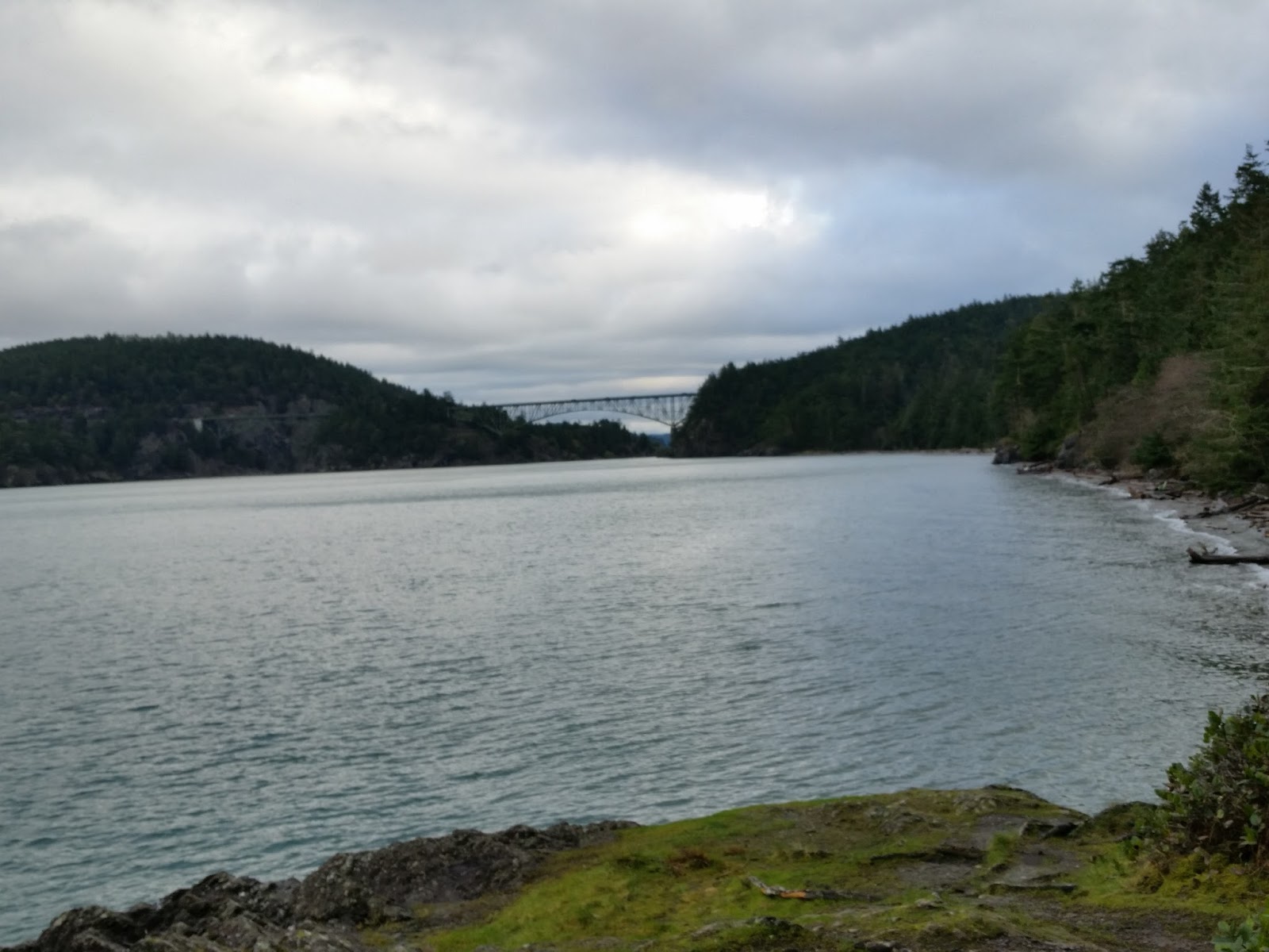
Parked next to the camp crew on the right
The camp crew are the crew that keep the base camp running smoothly. They unload and load supplies, make coffee in the morning, get fire wood for the campfire to help warm people (this is Alaska, after all!) do garbage runs and pretty much any other odd jobs that need to be done around camp. In base camp everyone sleeps in their tents (except me, who slept inside my hand-wash trailer on a cot) and we use porta-potties for our bathrooms. Hand-wash trailers, while common in the lower 48 states, are virtually unknown in Alaska.

Most wildfires in Alaska are allowed to burn until they go out by themselves. This year over 300 fires are burning in Alaska and only 22 of those fires are being actively fought. Most fire is started by lightening and there are few if any roads to access the burn areas. The frequent burns keep the Alaskan tundra healthy.
smoke from Aggie Creek Fire obscures the ridge line

The Aggie Creek Fire was fought because it threatened the economic livelihood of the state of Alaska, the Trans-Alaska oil pipeline which runs 800 miles down the center of Alaska from Prudhoe Bay in the north to Valdez in the south. There are a series of 12 pump stations along the pipeline and the Aggie Creek Fire at one point got within 100 feet of pump station #7.  Parts of the pipeline are buried and parts are above ground. We were camped literally right on top of the buried pipeline.
I am at mile 427 on the 800 mile pipeline
The pipeline was built during the oil crisis of the 1970s and it was completed by 1977. I remember hearing about it as a child, but I never realized what an engineering marvel it was. The oil is over 100 degrees and so to keep the permafrost from melting and destabilizing the soil, the pipeline is insulated and even refrigerated in places, and in other places it is above the ground. Over 85% of the Alaskan government revenue comes from the oil industry. There is no sales or income tax in Alaska, so it is heavily dependent on the oil industry. The lower oil prices recently are bad news for Alaskans.
Firefighter tents on top of the pipeline
selfie at a section of raised pipeline 
I was fortunate to be welcomed by the camp crew of mostly Athabascan natives. All one ever hears about are the Eskimos in Alaska, but the Athabascans are the natives of the interior of Alaska. They are a warm, friendly, generous people. I am not an expert in Athabascan culture, but I learned a lot living with them for three weeks. A key value is the sharing of food. The shooting of a youth's first moose is an important rite of passage and they are required to give the meat away to teach the importance of sharing. I also learned about Potlatches, which are usually a memorial service where gifts (blankets, guns, food, beadwork, etc.)  are given in memory of the family member who has passed. It can take up to a year or longer for a family to gather the items given at a Potlatch.

The day I arrived at camp, Mickey, the grey water truck driver had donated a large hunk of moose meat to the camp crew and they were preparing to cook it up for themselves. They wanted carrots, celery and onions to put in the moose stew so I texted my brother Donald, who was running an errand in Fairbanks, and asked him to pick up those items. Although I didn't know it at the time, this opened a door because we were participating in their cultural value of sharing.

moose meat stew being cooked over the open campfire

I'm eating moose stew in Alaska!
As the weeks passed I got to experience Yukon River salmon, moose and caribou cooked by the camp crew. This is all traditional Alaskan food.
Half dried Yukon River salmon donated by Joe and his son

cleaning the pot with a rock before starting salmon stew

The salmon is cooked over the fire

Boiled, fried and cooked on a stick, the Yukon River salmon drips with omega rich oil.
Caribou

even better with onions and green peppers
Connie showed me the blueberries to pick

There was also a caterer who provided breakfast, a sack lunch, and dinner for the firefighters and the camp. Camp quiet hours were from midnight to 0600. It was very strange to have 24 hour sunlight. The sun would kind of set around midnight and it would be rather twilightish until about 3 am.
I'm holding the sun!

Midnight at base camp. The smoke from the fire makes for a nice sunset.


Lined up to go through the catering line
The caterer decorated for Independence Day and served BBQ. There was a flag raising ceremony and patriotic music.
Zack's hand-wash trailer is decorated for the 4th of July

the trailer with the sack lunches and ice

Old Glory on July 4th
A typical day for me started at 0550 when my alarm would go off. I would get up, get dressed and then go outside and start the generator. Then I would clean and disinfect the sinks and counters and clean the mirrors. After that, I would go next door for some of Carol's famous camp coffee, which was percolated over the fire. This rich, dark java was soon a favorite for everyone in camp, and even the commanders from the Incident Command Post (ICP) would line up for her coffee at the 0800 morning briefings.
Carol's camp coffee, cooked over the fire on the tripod
I'd eat breakfast around 0700, pick up my sack lunch and be back by 0800 to turn off the generator before the morning briefing. (Although the last week they got a sound system and used my generator to run it so then I didn't have to worry about the noise) After the briefing was over I would fill out my equipment time card and have it signed by the camp boss. Then I would clean the sinks again and find a book to read. A friend gave me a huge box of books to take with me to Alaska and I started a book exchange reading box on the front tongue of the trailer for people to exchange books. The rest of the day would usually include a mid afternoon nap, a walk around camp, sitting around the campfire and talking to Carol and Connie from the camp crew or chatting with the bus drivers.

The firefighters are taken by bus (usually school bus) to drop points and then the bus driver sits on the bus and waits all day for them to return. They can not leave in case the crew has to be evacuated rapidly from the fire. An exception to this is if the bus driver's crew is "spiked out". That means that the fire crew hikes in (often 3 or more miles) and sets up a camp and stays camped out at the fire line for several days. Helicopters drop their food, gear and supplies to them. Then the bus driver waits at base camp with the rest of us until the crew hikes out to be picked up. Ryan, Colleen and Hannah were bus drivers who had crews spiked out so I got to know them around the campfire.
A helicopter takes a load of supplies from the heliopad to firefighters
Late afternoon I would usually clean the sinks again and then walk down to dinner when it started at 1630 (8:30pm). After walking back up from dinner I'd hang out at the trailer spot cleaning as needed since the firefighters were coming back in and using the trailer to shave, wash, brush their teeth and charge their cell phones. At midnight I would turn off the generator and go to bed.
Drivers Becca and Jason look at a donated fish that Connie holds
In addition to the camp crew, camp managers and the bus drivers the other people around camp were the pick-up truck drivers. They were hired to drive their pick-up trucks and do errands around camp, like take supplies places and haul garbage, firewood and people. Becca and I would usually eat breakfast together in the mornings. Another important person was Chip the potable water man. He owned a potable water truck and kept our hand-wash trailers full of water. He was a very nice and helpful man and even backed my trailer up for me (since I pretty much suck at backing up trailers).
I decided to try my hand at campfire cooking and I filled apples with brown sugar, oatmeal, cranberries and raisins, wrapped them in two layers of aluminum foil and buried them in the fire for an hour. It was a total experiment but turned out well.

The finished baked apple was quite delicious
We bought a cake for Connie's birthday. She is an amazing artist who made me a beautiful birch wood dragonfly painting.
My final week at camp, Zack returned home and an older gentleman named Jerry replaced him at his hand-wash trailer. Jerry is a very nice retired man who recently lost his wife to cancer. It was his first trip to Alaska and we got to play tourist a couple times and went on a hike to Wickersham Dome, toured the Morris Thompson Cultural Museum (I HIGHLY recommend this free museum and cultural art center in Fairbanks) and visited North Pole, Alaska. North Pole is a a town a few miles outside of Fairbanks and does a raging business at Christmas. All the light poles look like candy canes and the streets have Christmas theme names.
Jerry

I'm at the North Pole!
All good things must come to an end, and for me that happened after about three days of cold and rain. The rain began to quench the fire and it changed from a type 2 fire to a type 3 fire (less resources). The base camp moved to the Incident Command Post down the road and downsized dramatically and I was demobilized, although Jerry moved with his trailer to the ICP and will probably be there for several more days.
MUD!!

Cold and wet

Packing up and moving Jerry to the ICP

Fire Camp at Aggie Creek has been the experience of a lifetime for me. I have enjoyed authentic Alaskan cuisine and culture and met some absolutely amazingly wonderful people. I felt like I was blessed each day I was there.

If you would like to see more actual "fire" pictures, you can like the Aggie Creek Fire page on Facebook. There are some awesome pictures on that site.
You can also listen or read the story about Alaska fires and Aggie Creek Fire on NPR at http://www.npr.org/2015/07/23/425654442/across-wild-alaskan-terrain-firefighters-pick-their-battles


The Great Alaskan Adventure - Driving the AlCan

I read once that everyone should travel the Al-Can before they die. I can now check this off my bucket list. The Al-Can is the Alaska Canadian Highway, an isolated, ruggedly beautiful road that connects the lower 48 with Alaska via Canada's British Columbia and Yukon Territory. It was built during World War II to create a roadway to the Alaskan Territory. Many people don't realize that parts of Alaska were actually occupied by the Japanese during World War II, and the hastily constructed road had significant military importance as a supply line. Since then the gravel road has been paved and although the frost heaves (places where the pavement buckles because of the permafrost and winter weather) create yearly maintenance challenges, the road is actually in pretty good shape.

I was two days away from backpacking another section of the Pacific Crest Trail with my cousin, Kelley, when I got a call from my brother, Donald, asking me to go to Alaska to run his hand-wash trailer. He owns trailers that are rented during fire season to help firefighters have a place with warm water to wash their hands, which helps keep them healthy. Two days later he picked me up in Mt. Vernon, Washington, and we headed to Alaska, towing the trailer.
Donald and I 
We took Interstate 5 north and entered Canada at the Peace Arch. Donald did the bulk of the driving during the trip, which was great for me as I gazed at the scenery and kept track of our progress on the map. The high cliffs of the Fraser River Valley reminded me of the Columbia Gorge as we took Highway 1 north to connect to Highway 97. We passed river rafters as we hugged the Fraser River and then continued north along the Thompson River. The scenery along the Thompson was much drier than I expected, similar to eastern Washington. It was blazing hot and the thermometer eventually read 103 degrees. The air was smoky from a huge wildfire. 

For dinner we stopped in Prince George and then headed west on Highway 16. I drove a few hours while Donald napped and then he took over again and we drove until 11:00 pm, stopping for the night at the Shady Rest RV Park in Houston, B.C. 

The next morning we were up and out before 6:00, getting coffee at the local 7-11 and driving past a lovely ski resort before turning north on highway 37. Highway 37 is a rather rustic paved road, without any painted shoulder or center lines. I saw my first moose along this road, crossing a stream. The wildlife count would later include a momma black bear with two small cubs, a brown bear, two bison, a cow elk with calf and numerous squirrels.
A rainbow ahead

The sign at the turn off to highway 37
We gassed up the truck at every available opportunity since we never knew where the next gas would be. Highway 37 seemed like a very long section. Finally we entered the Yukon Territory and connected with Highway 1, the official Al-Can. Along the road people had spelled out their names using the rocks. Because we were in a hurry we didn't stop to do the same, although we did pause briefly at the Continental Divide Marker.
Raining at the Continental Divide
We stopped for dinner in Whitehorse and it seemed surreal to me to actually be in a place that I'd seen on Gold Rush and Ice Road Truckers. We continued on to my favorite part of the trip, Kluane Lake.
Donald drives near Whitehorse


10 o'clock at night and the sun is still up!
The sun set at midnight in an array of stunning colors and this was my first experience with the northern midnight sun. 
midnight at Kluane Lake


mist on Kluane Lake
Driving around Kluane Lake we kept an eye out for the frost heaves. Some parts were in gravel in preparation for paving. Eventually we pulled over at a rest area and slept for several hours.
full moon rising over Kluane Lake at midnight
After several hours of sleep, we got up and continued, stopping for breakfast and coffee at Ida's in Beaver Creek. We shared an order of caribou sausage hash as we updated our statuses on Facebook using the free WiFi.
breakfast with free wifi
Several miles later we crossed the border into Alaska and sighed with relief at the well maintained road on the American side. About 30 miles in we were flagged down by a man on the side of the road trying to get a jump for his truck. We didn't have any jumper cables, but Donald tried to jump him with his spare battery from the trailer. It didn't really work but we all flagged down another vehicle which did have jumper cables. It ended up that the man was a veteran who had actually lived on Whidbey Island at one point in time. Small world!

We rolled in to Fairbanks around 2:00 pm and scouted out a place to buy a shower. After showering, Don's son Zack met us and my trailer ended up being dispatched to the same fire that Zack was already on with Donald's other hand-wash station, the Aggie Creek Fire. What a blessing to be able to have the two trailers on the same fire! Zack's trailer was down by the mess tent and mine was placed up above where every one was camped.
Donald puts a few finishing touches on this new trailer. I slept inside the trailer on the cot. 

We are up and ready for business
It was an amazing experience to drive over 2,400 miles in three days. I never realized that British Columbia and the Yukon Territory are bigger than the American west coast of California, Oregon and Washington. From hanging out with my brother, to seeing wildlife and experiencing Canada and Alaska, the drive has been unforgettable.